| Trails of Yosemite |
 |
| Original photo collection of sceneries along Walking, Hiking and Backbacking Trails, located (installed) in Yosemite National Park (California, USA). |
|
    |
|
|
|
|
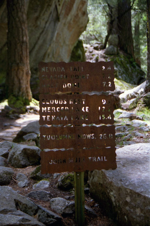
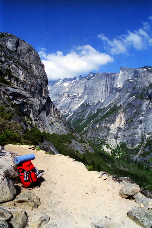
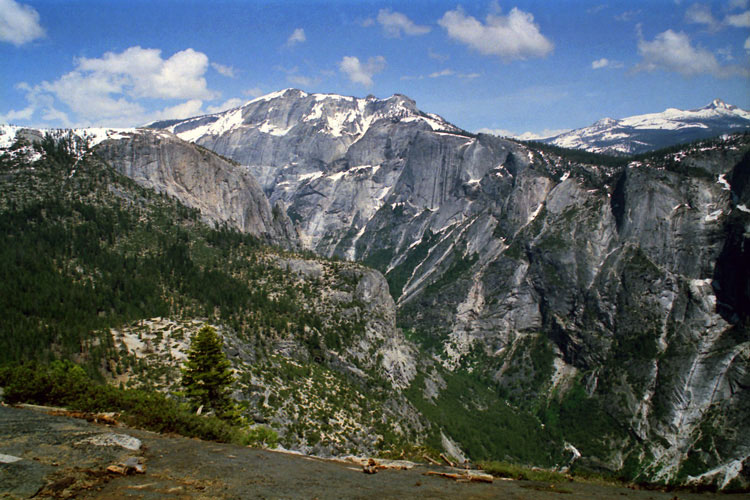
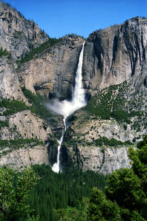
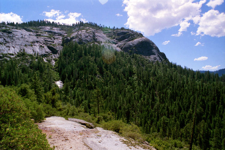
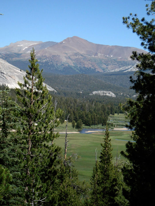
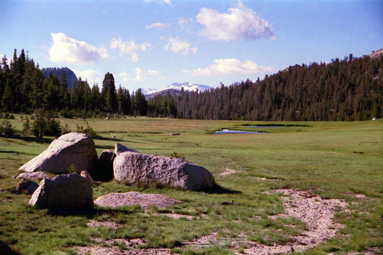
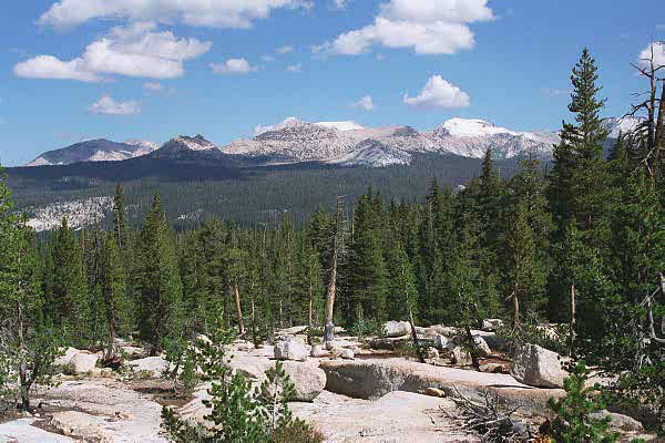
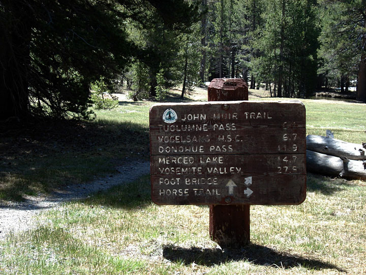
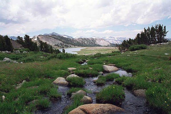
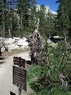
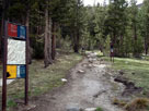
| John Muir Trail |
|
 |
|
 |
|
 |
|
 |
|
|
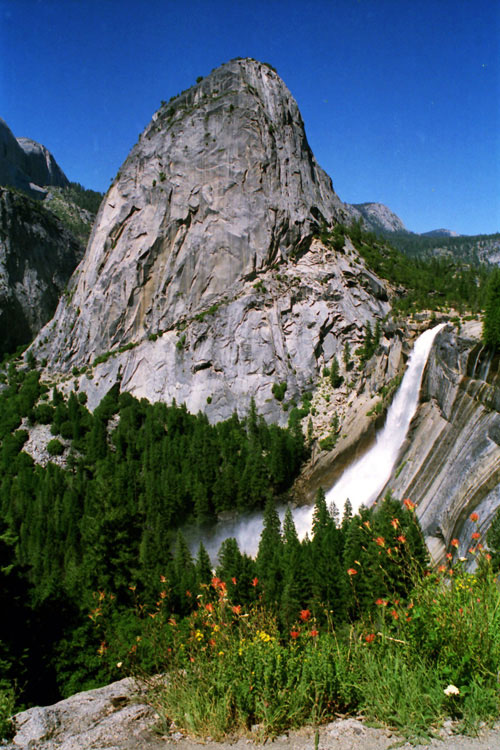
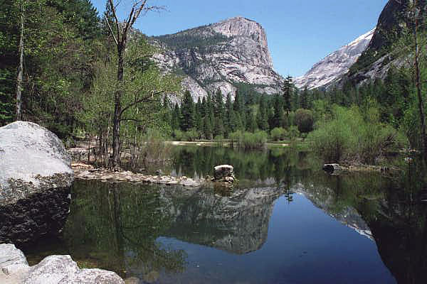
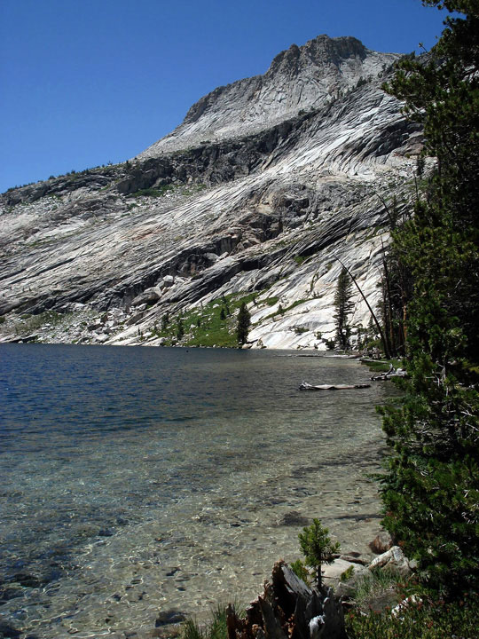
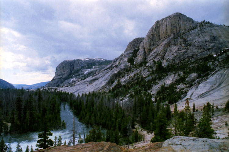
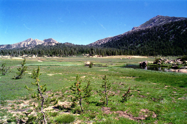
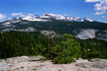
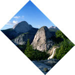
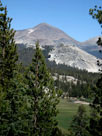
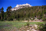
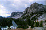
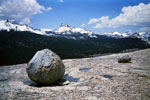
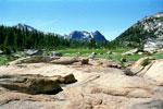
Liberty Cap and
Nevada Fall from
John Muir Trail |
|
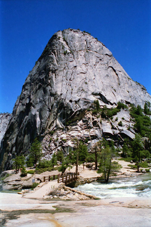
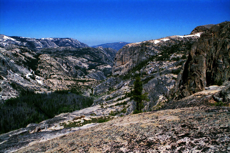
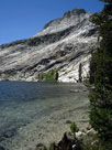
Liberty Cap and
John Muir Trail
(top of Nevada Fall) |
|
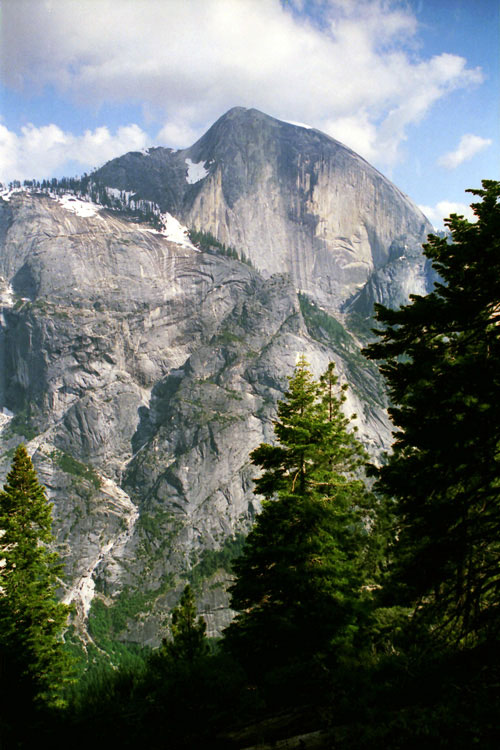
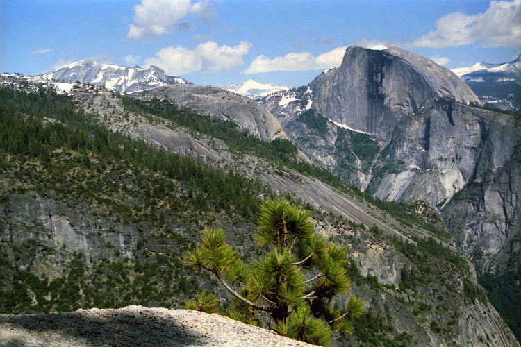
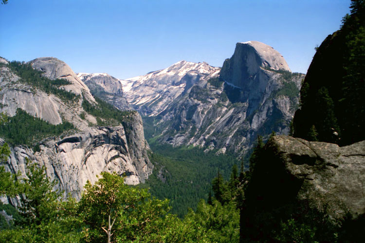
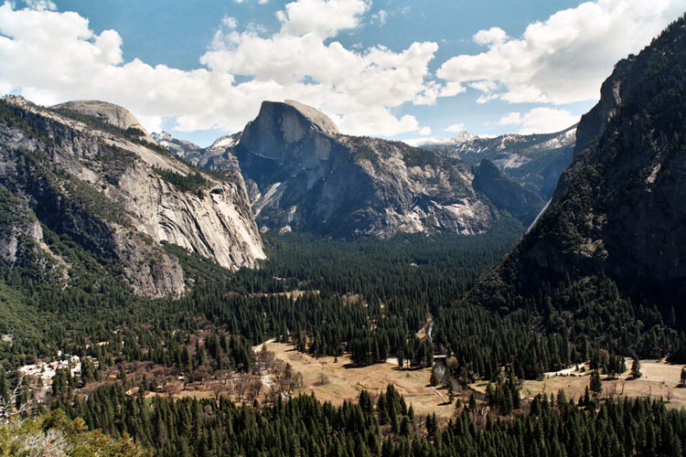
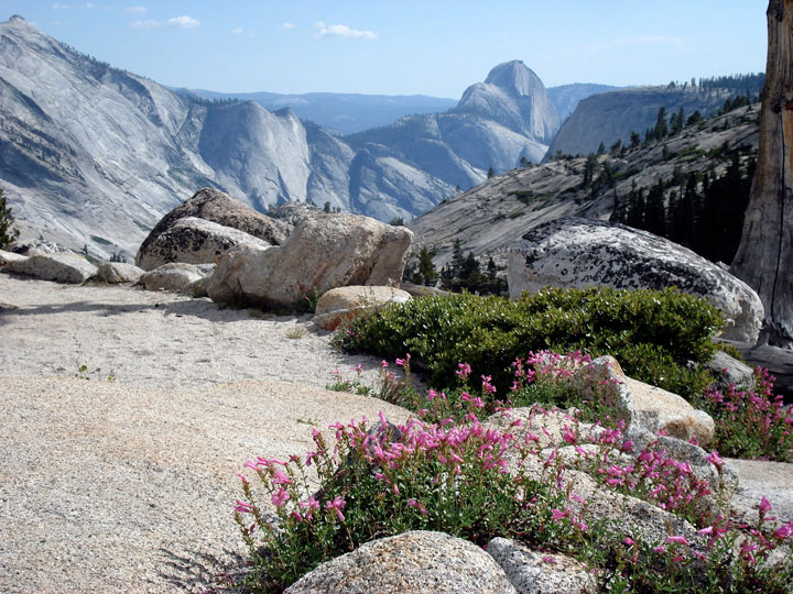
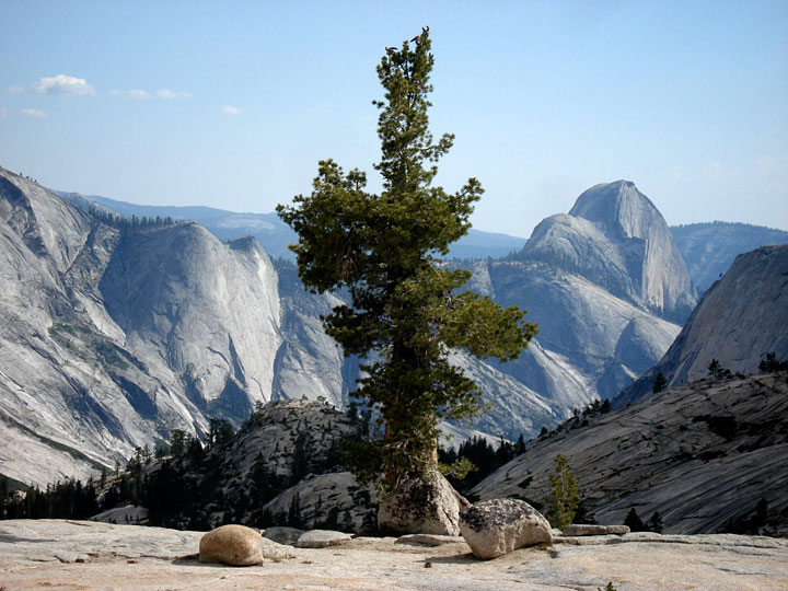
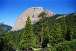
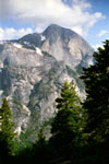
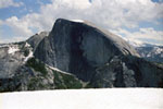
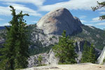
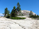
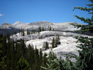
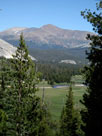
Half Dome from
John Muir Trail |
|
|
|
|
| Mist Trail |
|
 |
|
 |
|
 |
|
 |
|
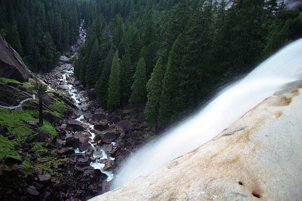
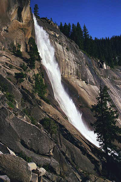
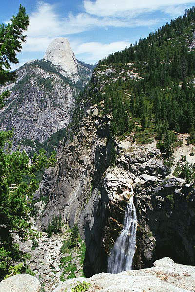
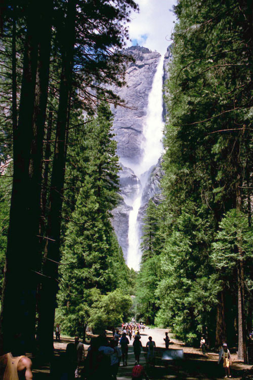
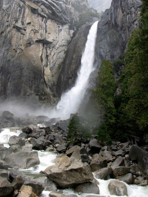
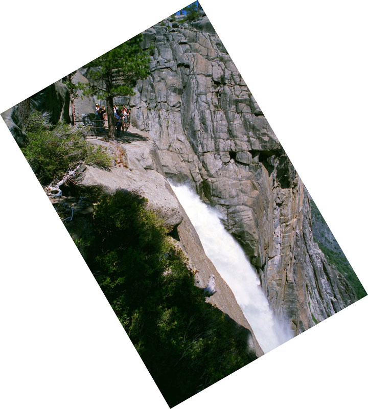
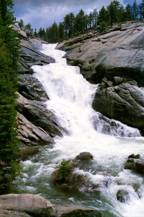
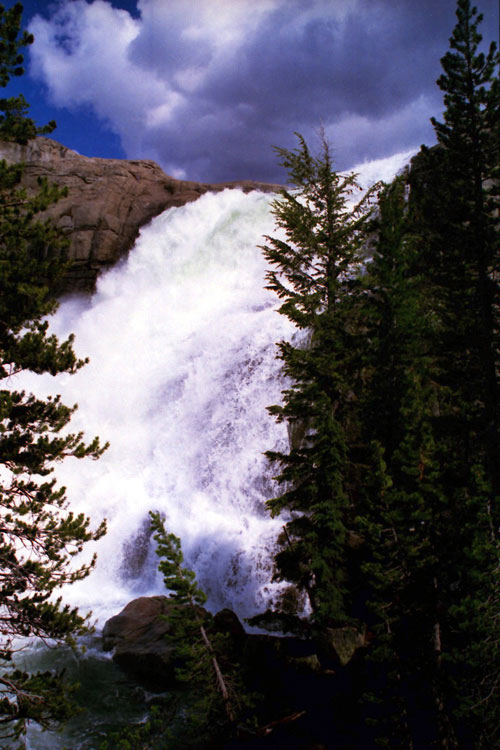
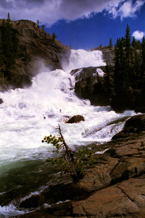
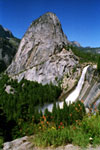
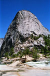
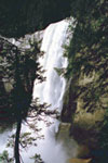
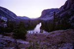
Vernal Fall
from Mist Trail |
|
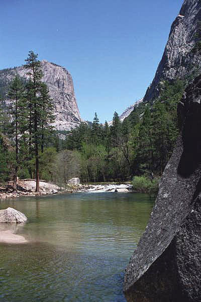
Merced River and Mist Trail
from top of Vernal Fall |
|
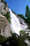
Nevada Fall from Mist Trail |
|
|
|
|
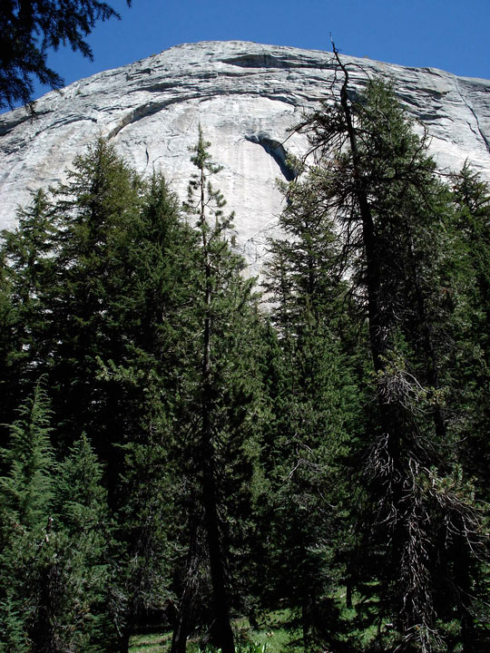
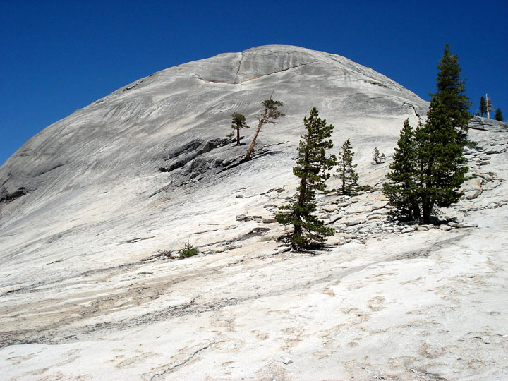
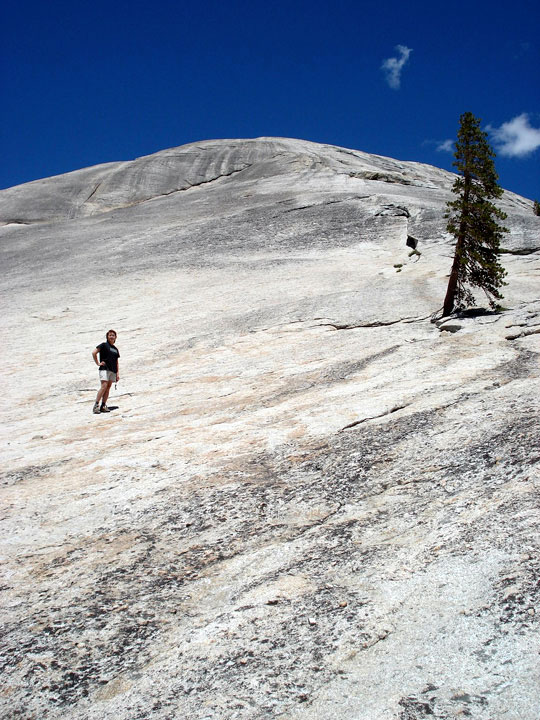
| Half Dome Trail |
|
 |
|
 |
|
 |
|
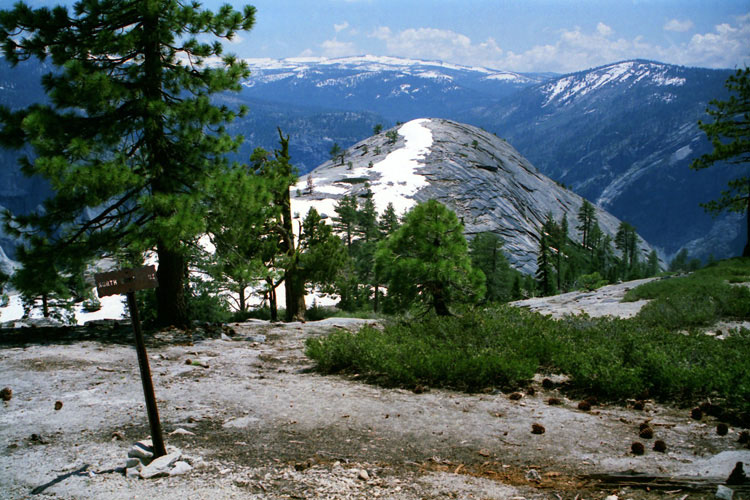
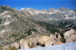
Clouds Rest and
Half Dome Trail |
|
Mount Clark from
Half Dome Trail |
|
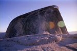
Half Dome summit
and Half Dome Cable |
|
|
|
|
|
|
|
|
|
| Snow Creek Trail |
|
 |
|
 |
|
 |
|
 |
|
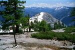
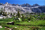
Half Dome from
Snow Creek Trail |
|
Tenaya Canyon,
Quarter Domes and
Snow Creek Trail |
|
Half Dome from
Snow Creek Trail |
|
Mt. Watkins, Tenaya Canyon,
Clouds Rest and
Quarter Domes |
|
|
|
|
| North Dome Trail |
|
 |
|
 |
|
 |
|
Clouds Rest, North Dome
and Half Dome
from Yosemite Point |
|
North Dome from
North Dome Trail |
|
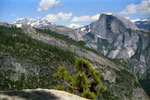
Half Dome from
North Dome summit |
|
|
|
|
| Glacier Point Trail |
|
 |
|
 |
|
 |
|
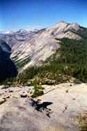
Half Dome and
Glacier Point Trail |
|
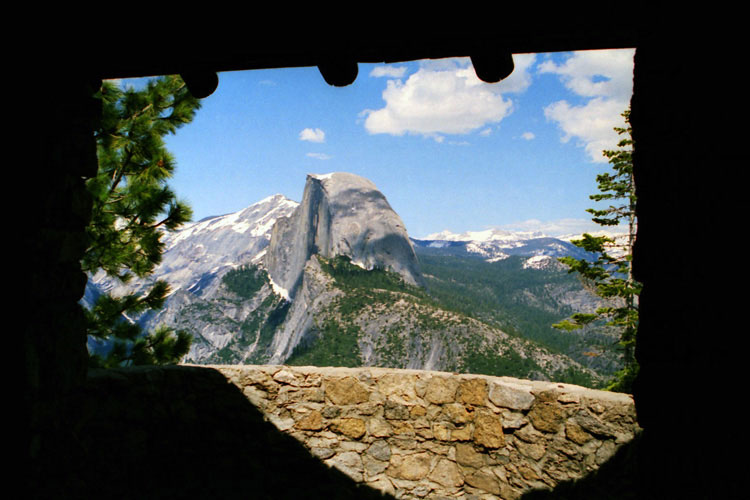
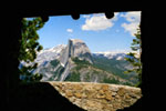
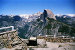
Half Dome from
Geological Exhibit |
|
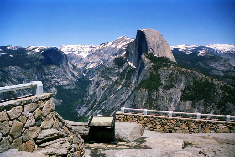
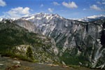
Tenaya Canyon and Half
Dome from Glacier Point |
|
|
|
|
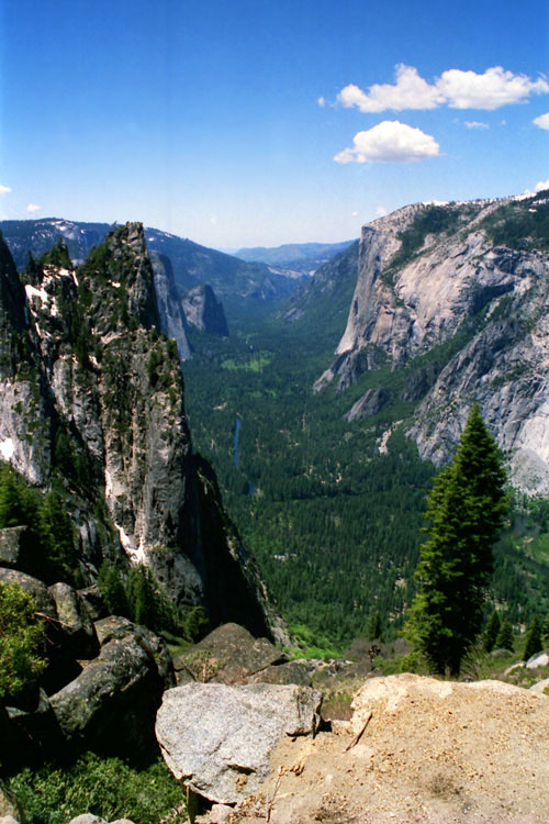
| Four Mile Trail (4-Mile Trail) |
|
 |
|
 |
|
 |
|
 |
|
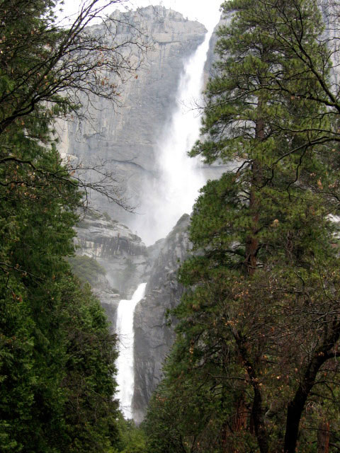
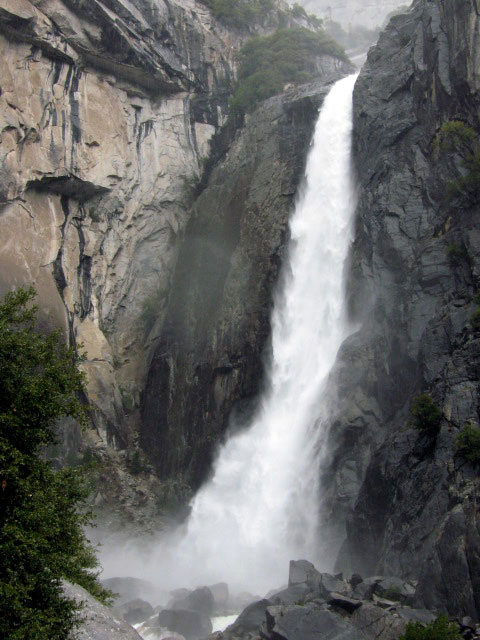
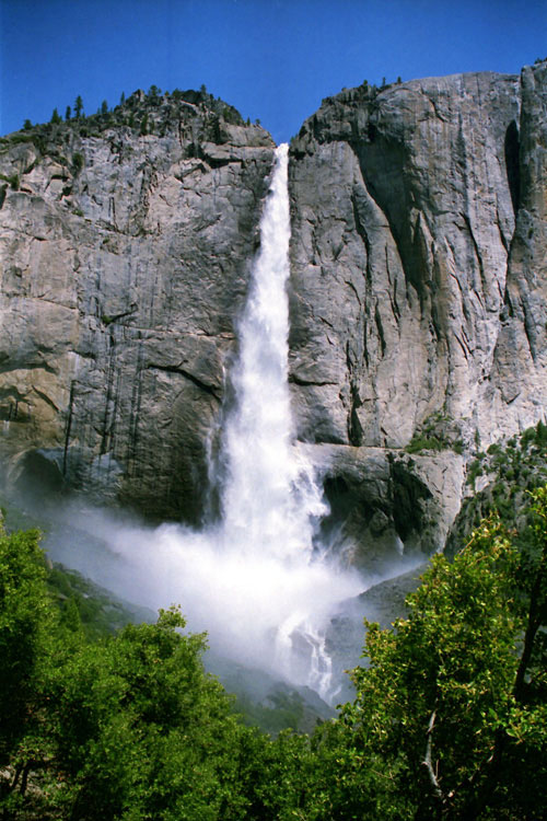
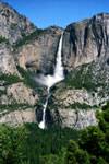
Yosemite Falls from
Four Mile Trail |
|
North Dome, Mount Watkins,
Clouds Rest and Half Dome |
|
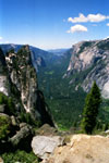
Sentinel Rock,
El Capitan and
Yosemite Valley
from 4-Mile Trail |
|
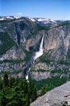
Yosemite Falls from
Four Mile Trail |
|
|
|
|
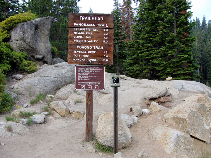
| Panorama Trail |
|
 |
|
 |
|
 |
|
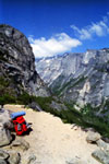
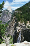
Half Dome and
Illilouette Fall from
Panorama Trail |
|
Half Dome from
Panorama Point |
|
Half Dome, Mount Broderick,
Liberty Cap and Nevada Fall |
|
|
|
|
| Pohono Trail |
|
 |
|
 |
|
Pohono Trailhead
at Glacier Point |
|
Tunnel View
(Pohono Trailhead) |
|
|
|
|
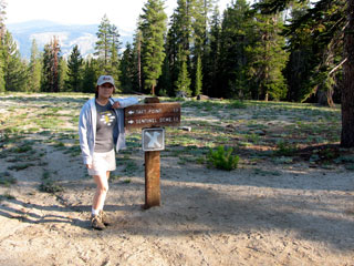
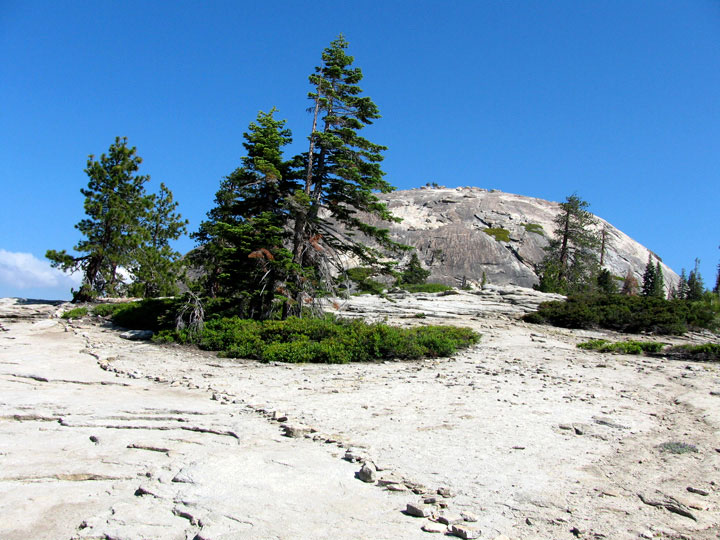
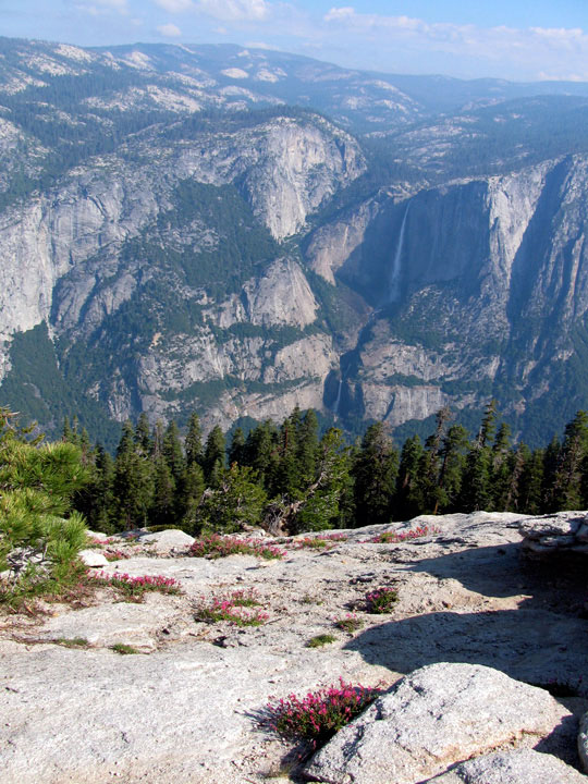
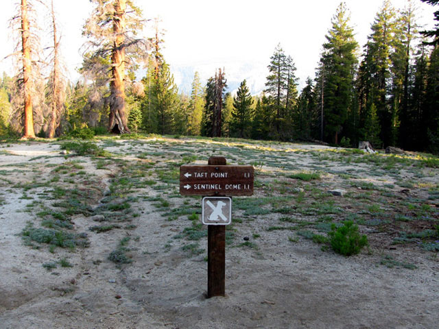
| Sentinel Dome Trail |
|
 |
|
 |
|
 |
|
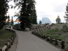
Sentinel Dome Trailhead
off Glacier Point Road |
|
Sentinel Dome from
Sentinel Dome Trail |
|
Yosemite Falls
from Sentinel
Dome summit |
|
|
|
|
|
|
|
|
|
|
|
|
|
|
|
|
|
|
|
|
|
|
|
|
|
|
|
|
|
|
|
|
|
|
| Wapama Falls Trail |
|
 |
|
 |
|
 |
|
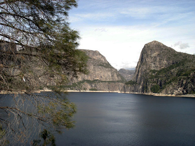
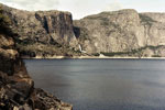
Wapama Falls, Hetch
Hetchy Dome and
Hetch Hetchy Reservoir |
|
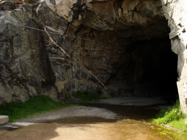
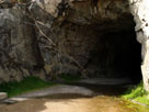
Tunnel of O'Shaughnessy
Dam (Wapama Falls Trail) |
|
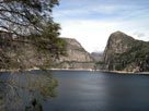
Hetch Hetchy Reservoir
and Kolana Rock from
Wapama Falls Trail |
|
|
|
|
|
|
|
|
|
|
|
|
|
|
|
|
|
|
|
|
|
|
|
|
|
|
|
|
|
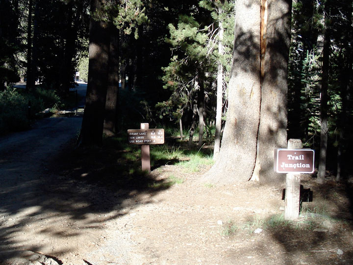
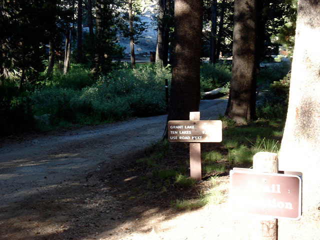
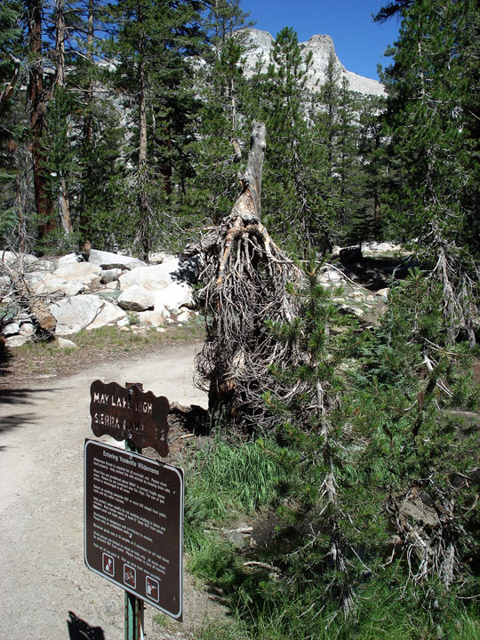
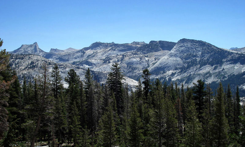
| May Lake Trail |
|
 |
|
 |
|
 |
|
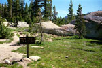
| May Lake Trailhead |
|
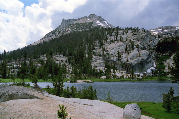
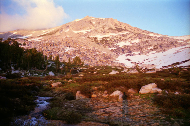
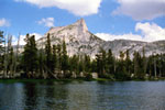
Cathedral Peak to Tenaya Peak
from May Lake Trail |
|
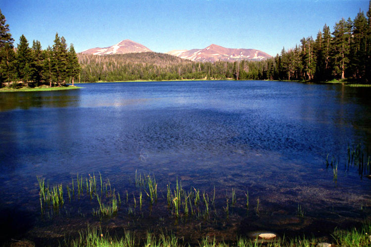
Mount Hoffmann
(eastern opeaks)
and May Lake |
|
|
|
|
|
|
|
|
|
|
|
|
|
|
|
|
|
|
|
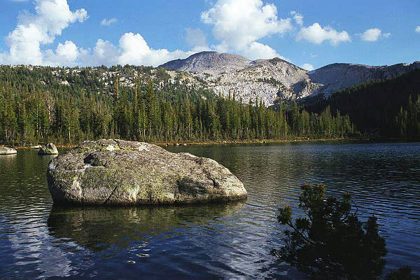
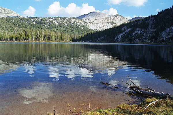
| Tenaya Lake Trail |
|
 |
|
 |
|
 |
|
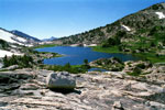
Ragged Peak, Mount
Conness, White Mountain
and Pothole Dome
from Tenaya Lake Trail |
|
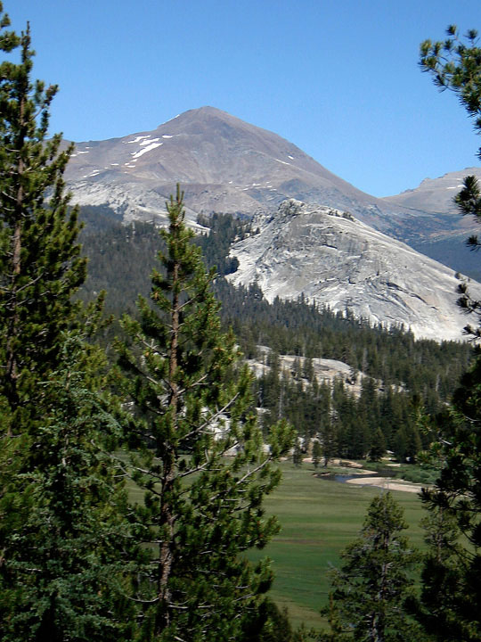
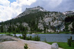
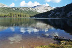
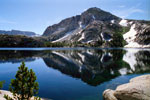
Mount Dana and
Lembert Dome |
|
Mount Gibbs |
|
|
|
|
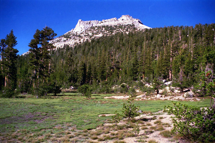
| Fairview Dome Trail |
|
 |
|
 |
|
 |
|
 |
|
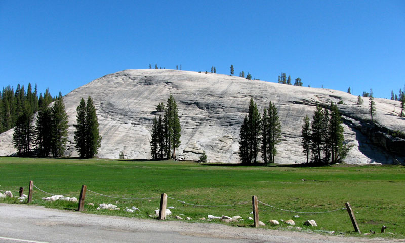
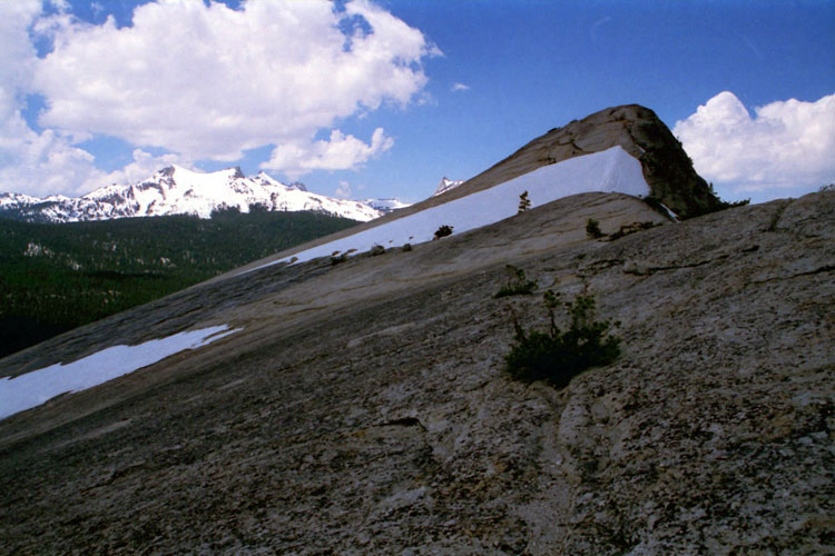
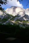
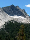
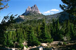
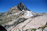
West face of
Fairview Dome from
Fairview Dome Trail |
|
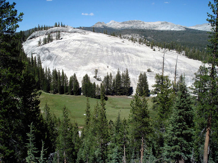
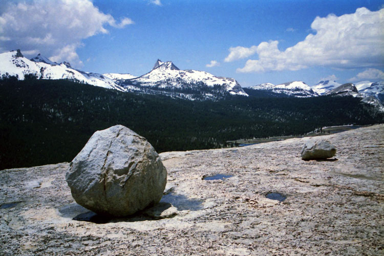
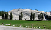
Southwest slope of
Fairview Dome |
|
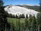
South slope of
Fairview Dome |
|
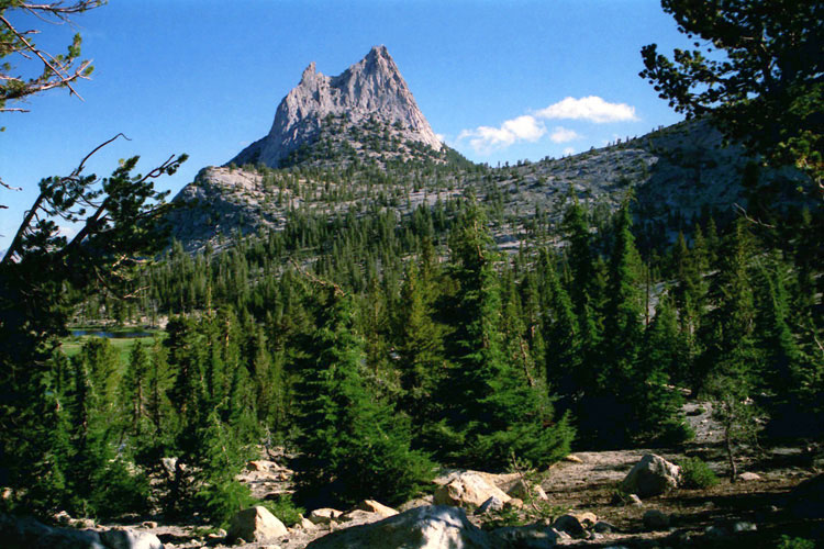
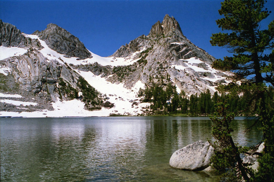
Cathedral Peak
from south slope
of Fairview Dome |
|
|
|
|
| Pothole Dome Trail |
|
 |
|
 |
|
Pothole Dome from Tioga Road
(Pothole Dome Trailhead) |
|
Mt. Conness, Pothole Dome
and Pothole Dome Trail
from Tenaya Lake Trail |
|
|
|
|
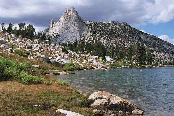
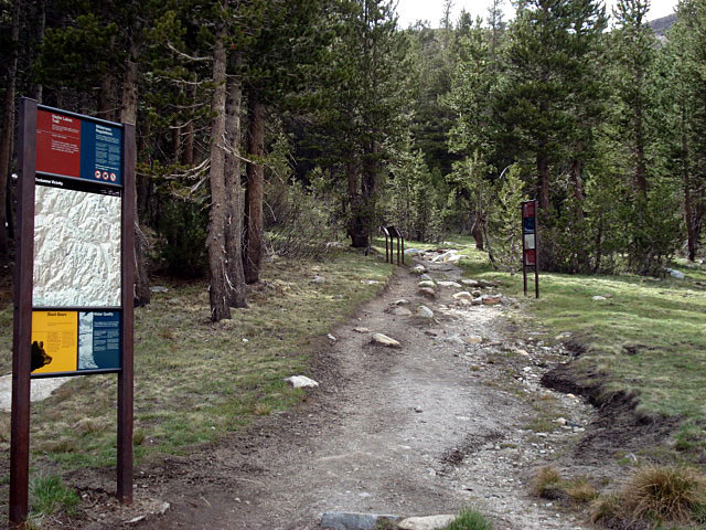
| Cathedral Lakes Trail (John Muir Trail) |
|
 |
|
 |
|
 |
|
Fairview Dome and Tioga Road
at Catherdral Lakes Trailhead |
|
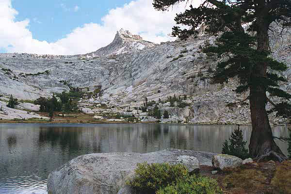
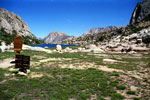
Cathedral Peak and
Lower Cathedral Lake |
|
Tresidder Peak and
Upper Cathedral Lake
from John Muir Trail |
|
|
|
|
| John Muir Trail [Cont'd] |
|
 |
|
 |
|
 |
|
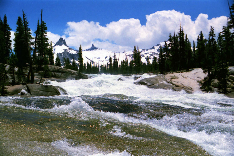
Cathedral Peak from
near Cathedral Pass |
|
Cathedral Pass and
John Muir Trail |
|
Tresidder Peak
from Cathedral Pass |
|
|
|
|
|
|
|
|
|
| Elizabeth Lake Trail |
|
 |
|
 |
|
 |
|
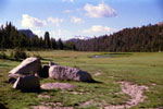
Elizabeth Lake Trailhead
near Tuolumne Meadows
Campground |
|
Johnson Peak and Elizabeth Lake |
|
|
|
|
|
|
|
|
|
|
|
|
|
|
| Glen Aulin Trail (Pacific Crest Trail) |
|
 |
|
 |
|
 |
|
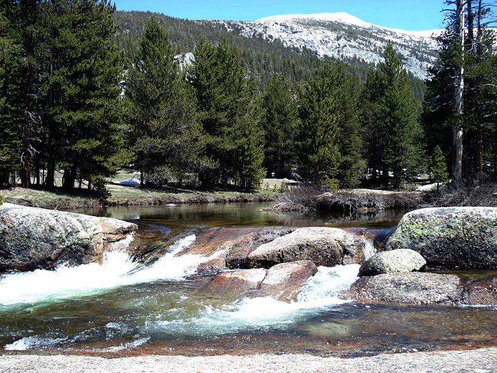
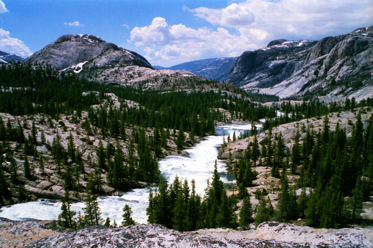
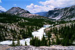
Peak 9,134, Wildcat Point
and Tuolumne River
from Glen Aulin Trail |
|
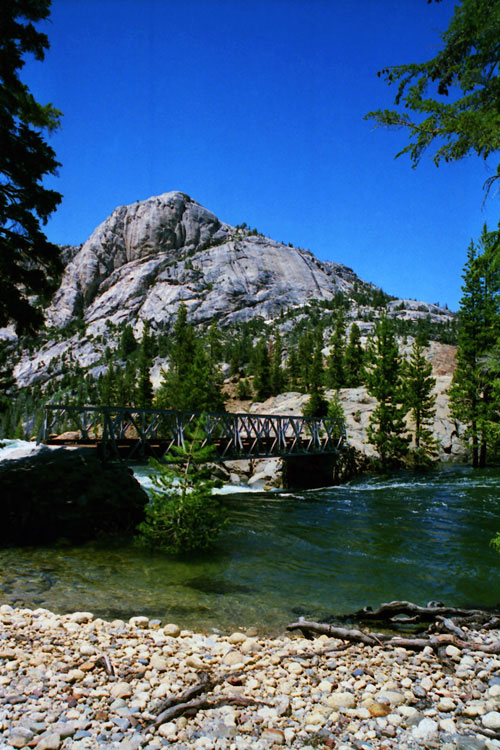
Peak 8,886, Glen
Aulin Bridge and
Tuolumne River |
|
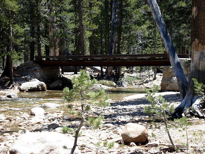
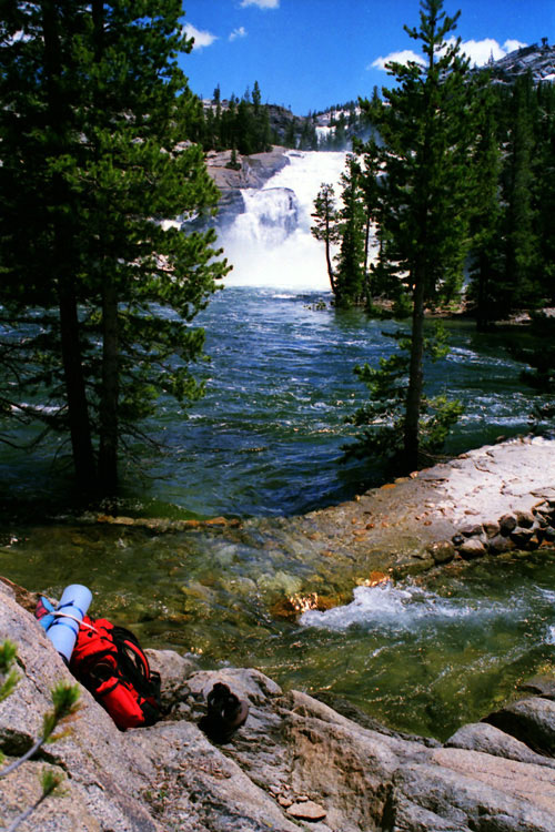
White Cascade and
Glen Aulin Trail
(under water) |
|
|
|
|
| Tuolumne River Trail |
|
 |
|
 |
|
 |
|
Peak 9,069, Peak 8,886,
Tuolumne River and
Tuolumne River Trail
through Glen Aulin |
|
Peak 9,069, Tuolumne River
and Tuolumne River
Trail (in woods) |
|
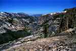
Grand Canyon of the
Tuolumne (east end) from
Peak 8,886 summit |
|
|
|
|
|
|
|
|
|
|
|
|
|
|
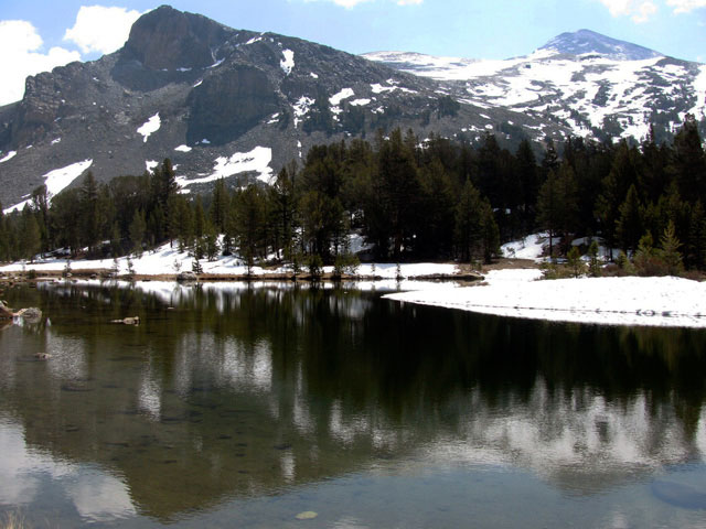
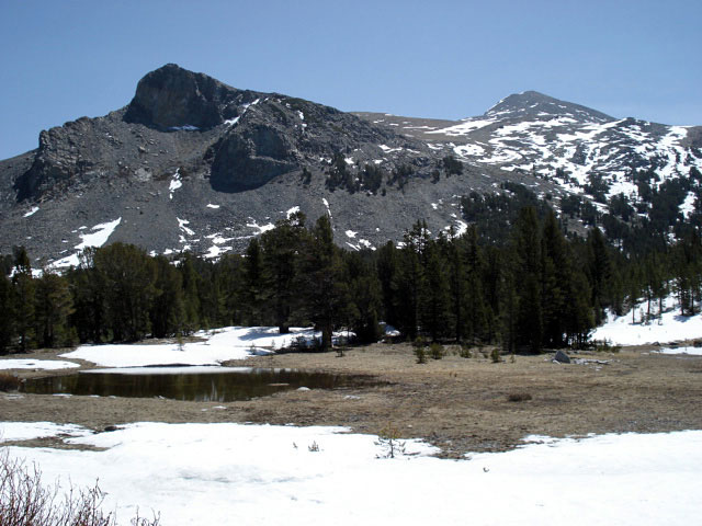
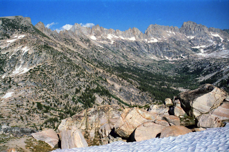
| Mount Conness Trail (Mt. Conness Trail) |
|
 |
|
 |
|
 |
|
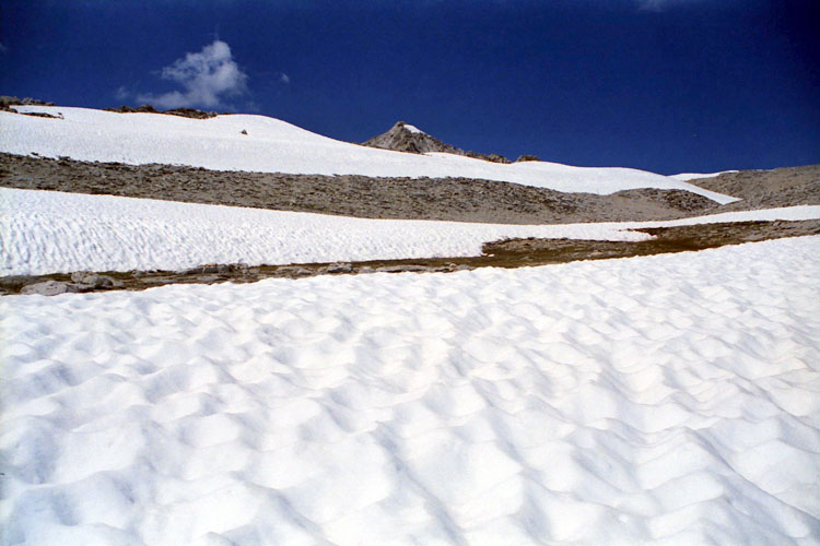
Mount Conness (in cloud),
Peak 11,806 and
creek from Lake 10,560+
along Mount Conness Trail |
|
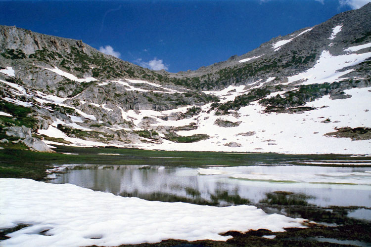
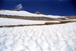
Pass 11,400+
and Lake 10,560+ |
|
Mount Conness summit
from Conness Plateau |
|
|
|
|
| Lembert Dome Trail |
|
 |
|
 |
|
Unicorn Peak and
Lembert Dome summit |
|
Cathedral Peak from
Lembert Dome summit |
|
|
|
|
|
|
|
|
|
| Gaylor Lakes Trail |
|
 |
|
 |
|
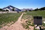
Gaylor Lakes Trailhead
at Tioga Pass |
|
Mammoth Peak,
Cathedral Range and
Middle Gaylor Lake |
|
|
|
|
|
|
|
|
|
| Burro Pass Trail |
|
 |
|
 |
|
 |
|
Sawtooth Ridge
and Matterhotn Peak
from Mule Pass |
|
Sawtooth Ridge
from Burro Pass Trail |
|
Finger Peaks
from Burro Pass |
|
|
|
|
| Rock Island Pass Trail |
|
 |
|
 |
|
 |
|
Rock Island Pass Trail
into Yosemite National Park |
|
Kettle Peak and Snow Lake
(Hoover Wilderness)
from Rock Island Pass |
|
Rock Island Pass
and Snow Lake from
Rock Island Pass Trail |
|
|
|
|
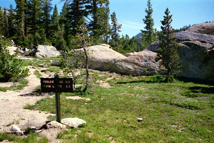
| Peeler Lake Trail |
|
 |
|
 |
|
 |
|
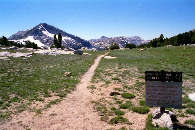
Kerrick Meadow from
Peeler Lake Trail |
|
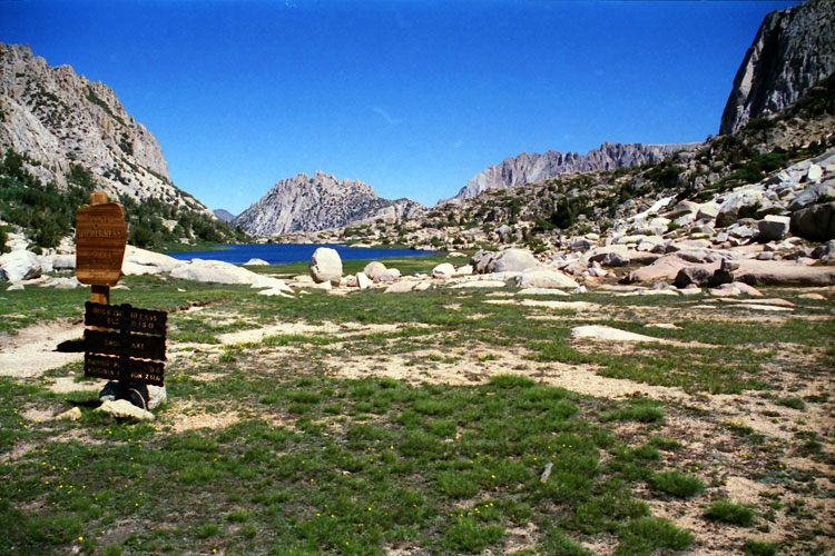
Peeler Lake Trail
to Peeler Lake |
|
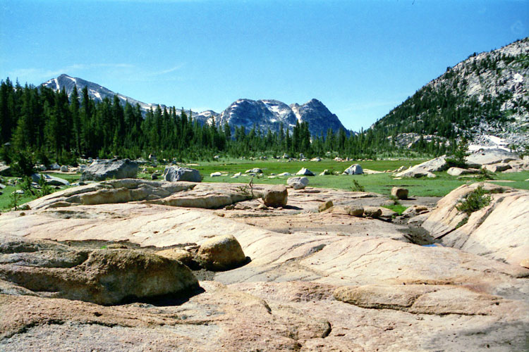
Crown Point and Peeler Lake
(Hoover Wilderness) |
|
|
|
|
|
|
|
|
|
| Yosemite Trails Photos on Web |
|
|
|
|