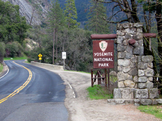
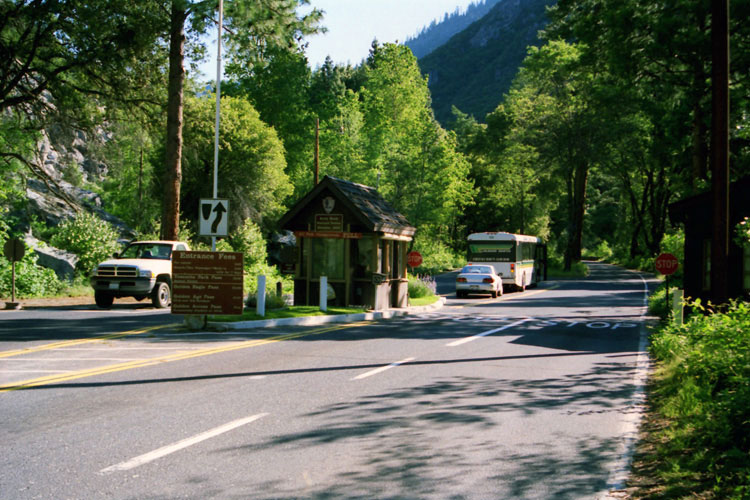
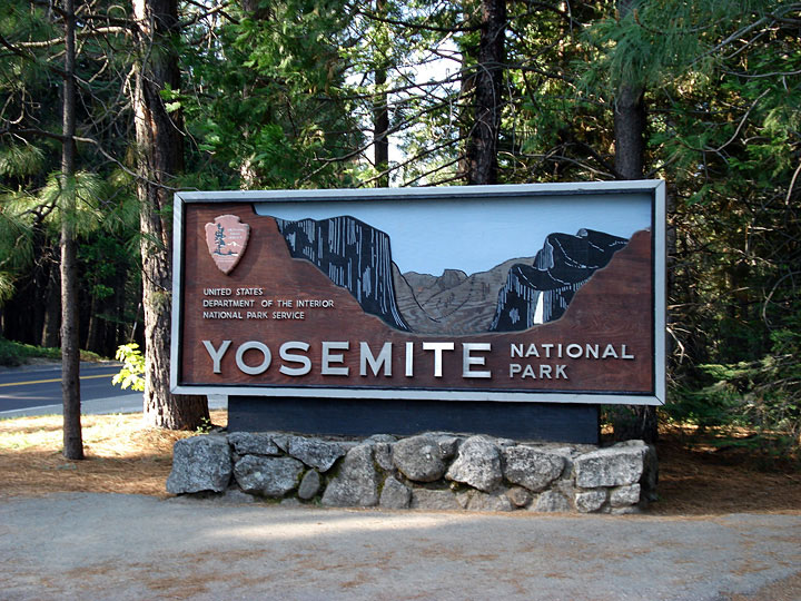
| Yosemite National Park |
 |
|
|
|
|
|
|
|
|
|
|
| Yosemite Valley |
|
 |
|
 |
|
 |
|
 |
|
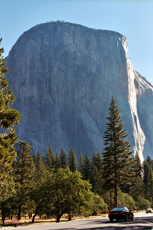
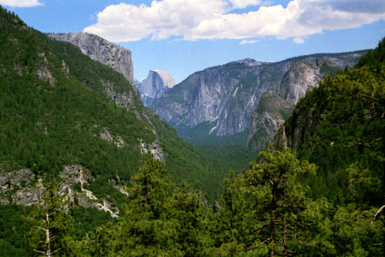
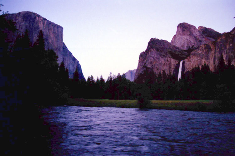
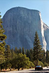
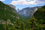
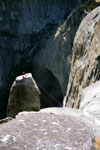
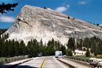
El Capitan and
Southside Drive |
|
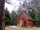
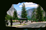
Yosemite Chapel |
|
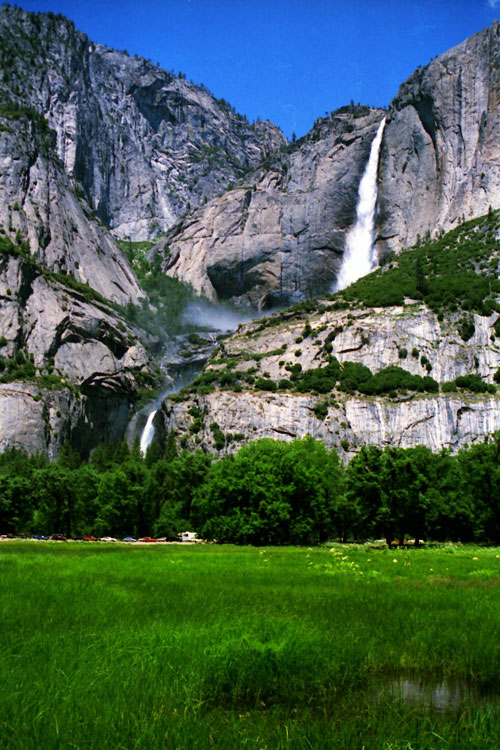
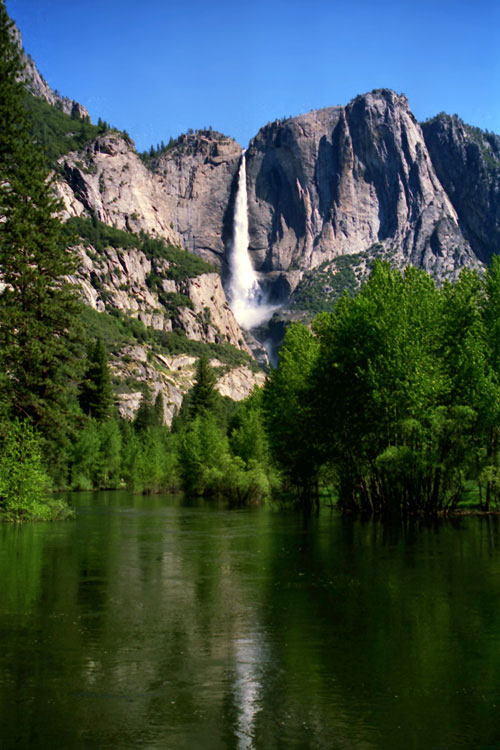
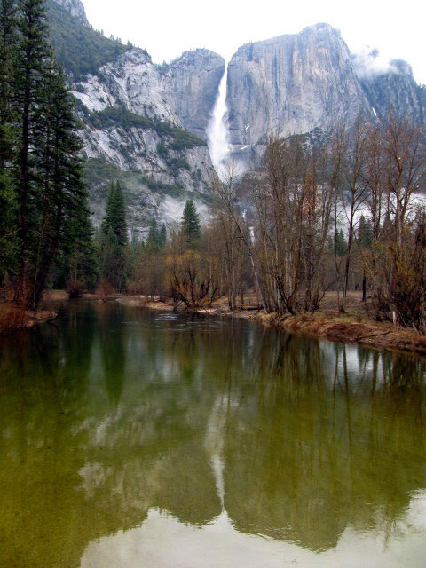
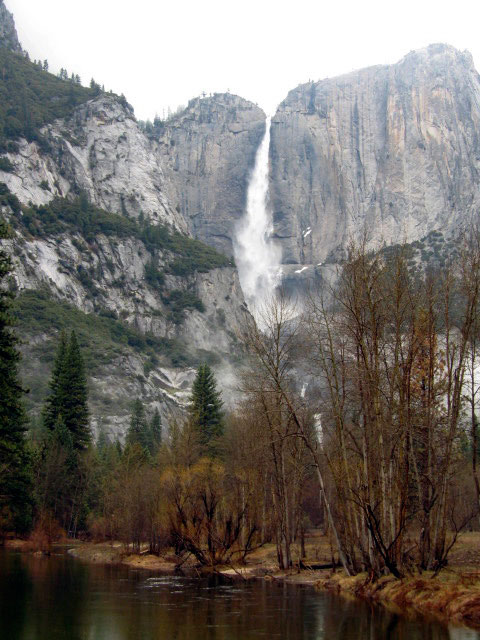
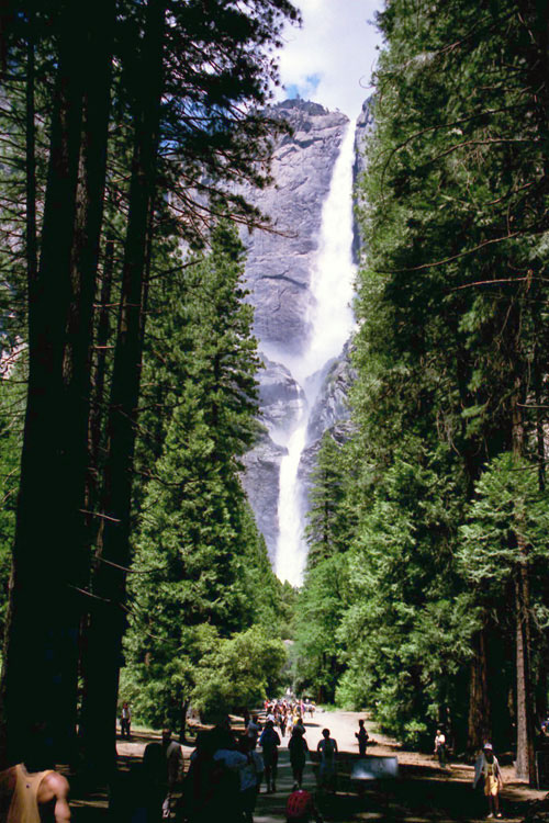
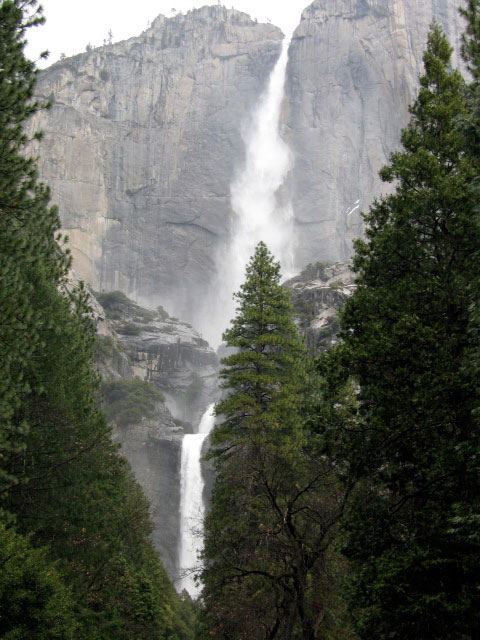
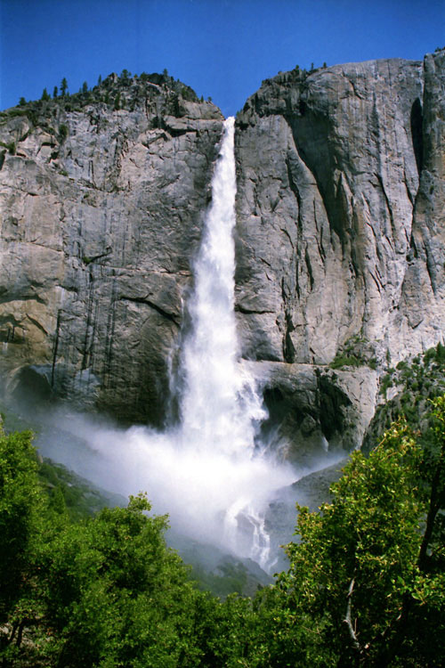
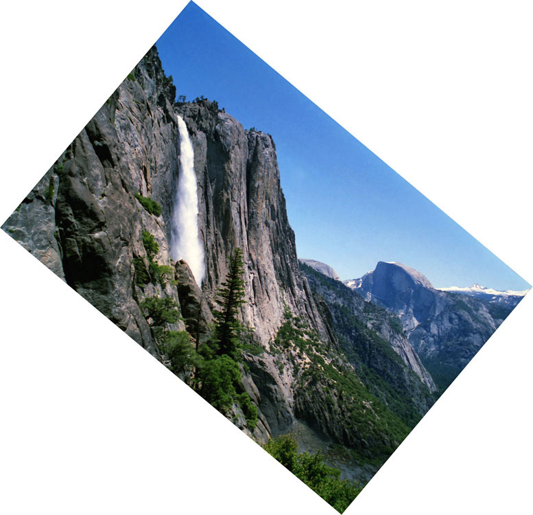
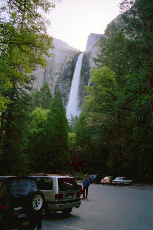
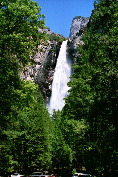
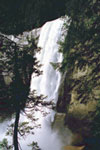
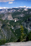
Yosemite Falls from
Sentinel Drive |
|
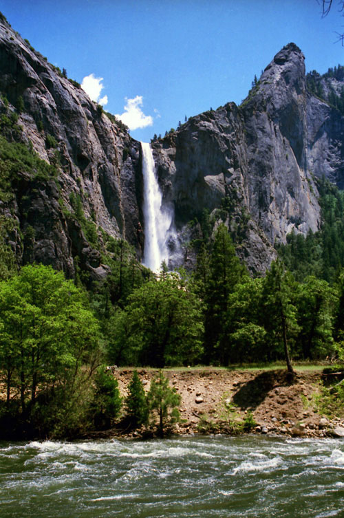
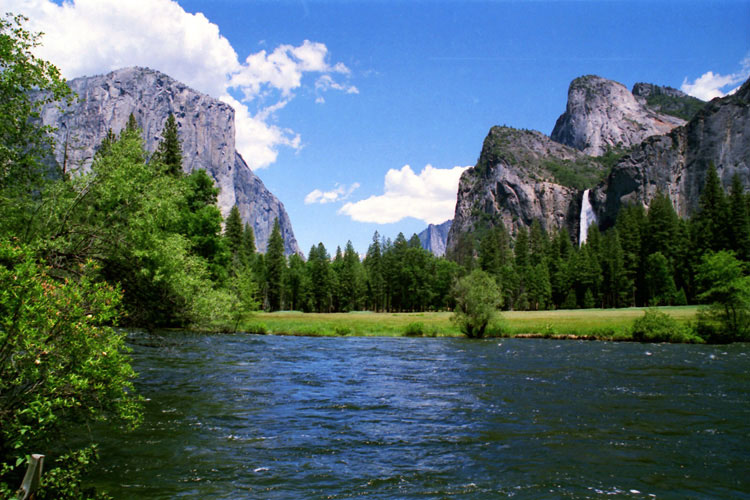
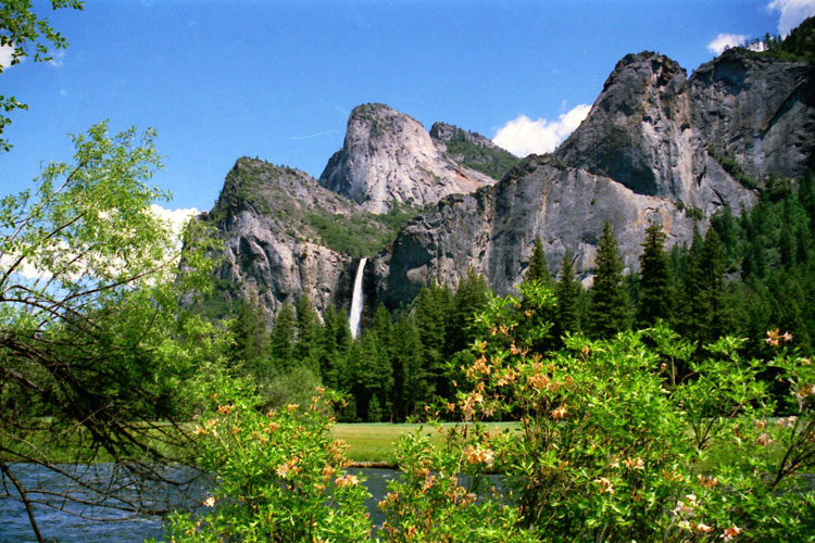
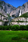
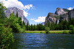
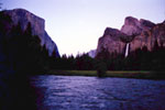
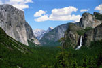
Bridalveil Fall and
Merced River from
Northside Drive |
|
|
 |
|
 |
|
 |
|
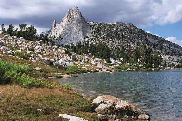
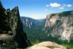
Sentinel Rock, Cathedral
Rocks, El Capitan
and Yosemite Valley
from Four Mile Trail |
|
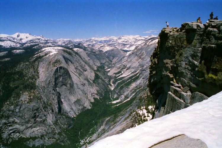
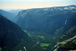
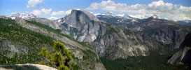
El Capitan, Yosemite Falls
and Yosemite Valley from
Half Dome summit |
|
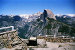
El Capitan, Half Dome,
Sentinel Dome
and Yosemite Valley
from Wawona Road |
|
|
|
|
|
|
|
|
|
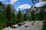
| Curry Village |
|
 |
|
 |
|
 |
|
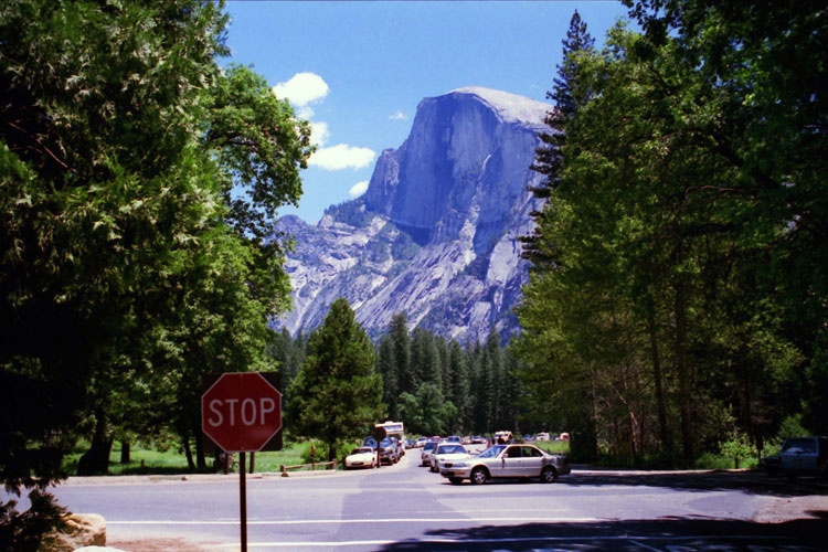
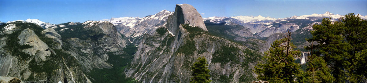
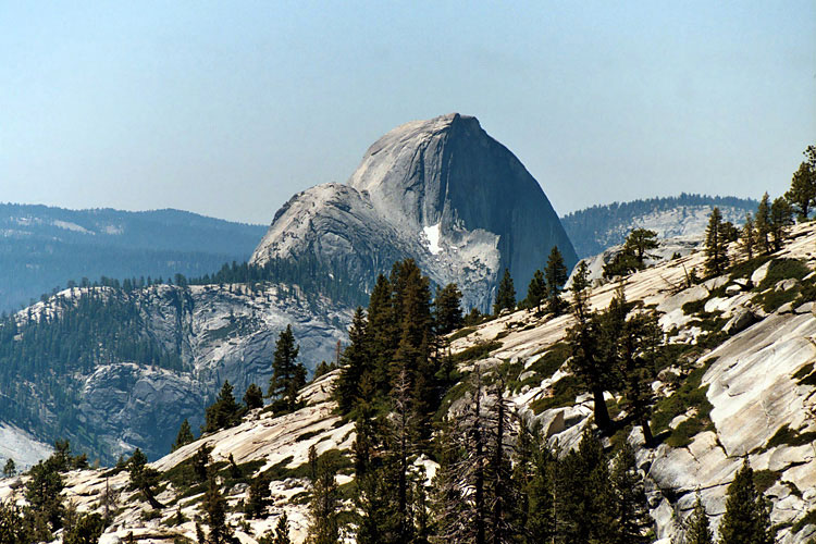
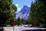
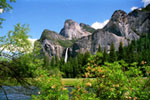
Half Dome from Southside
Drive near Curry Villlage |
|
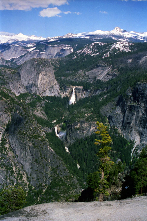
Glacier Point and
Staricase Falls
from Curry Village |
|
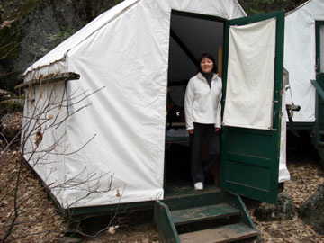
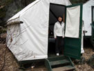
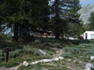
Tent Cabin, Curry Village |
|
|
|
|
|
|
|
|
|
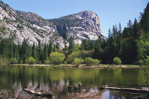
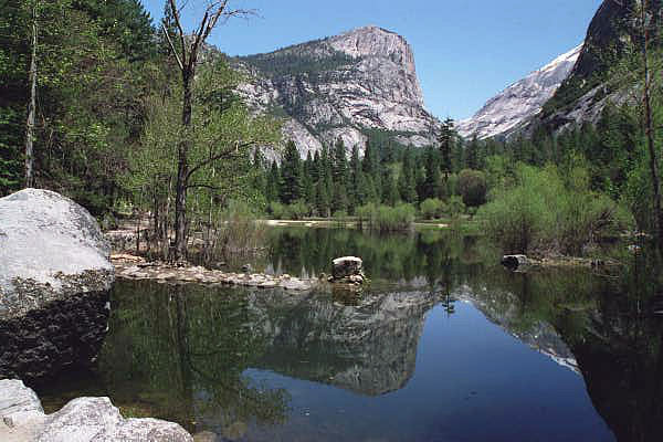
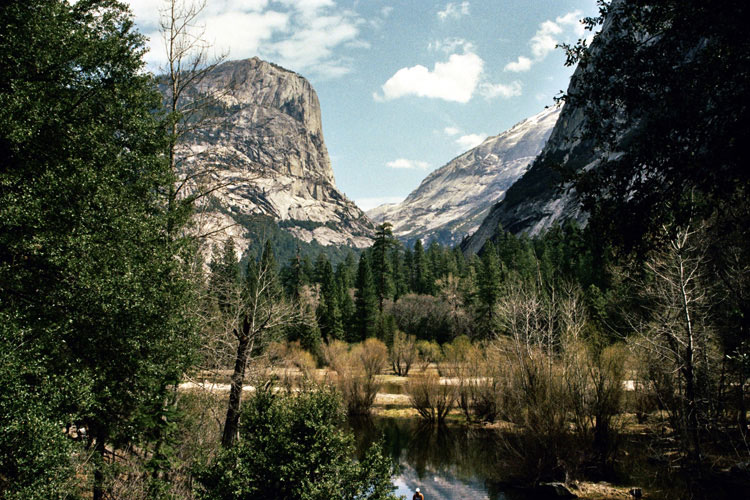
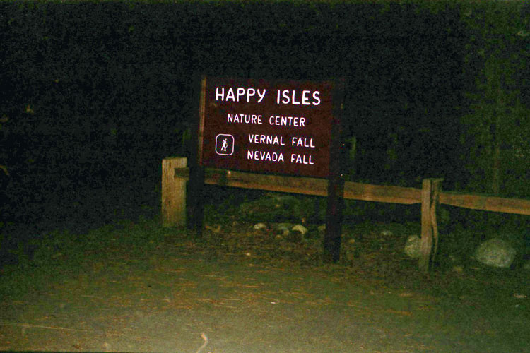
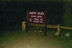
| Happy Isles |
|
 |
|
 |
|
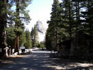
John Muir Trailhead,
Happy Isles |
|
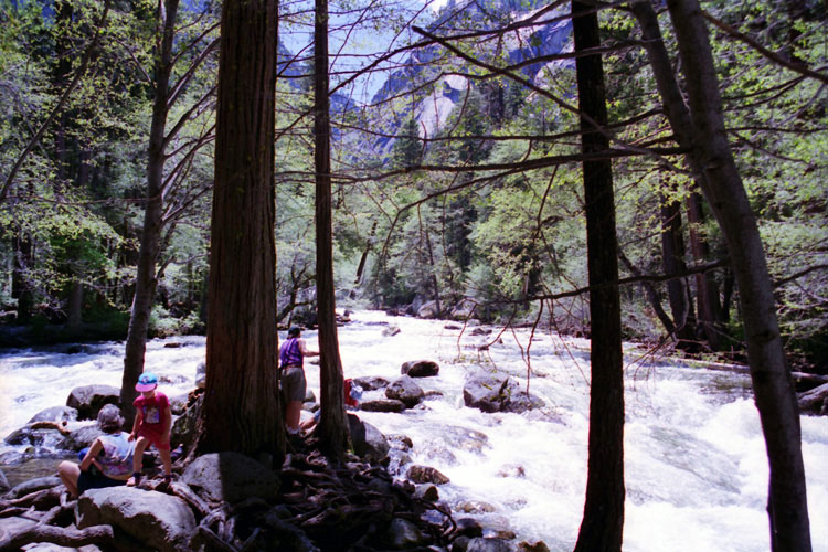
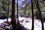
Merced River
near Happy Isles |
|
|
|
|
| Vernal Fall - Mist Trail |
|
 |
|
 |
|
 |
|
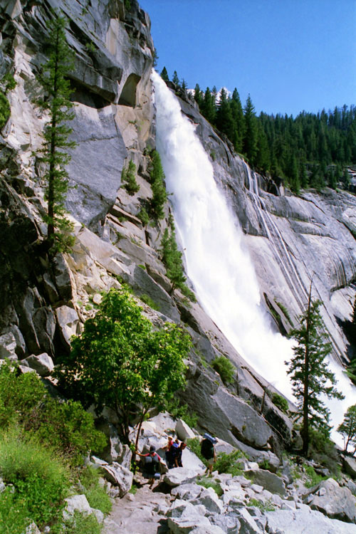
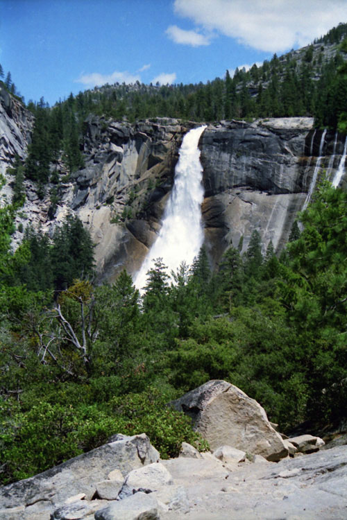
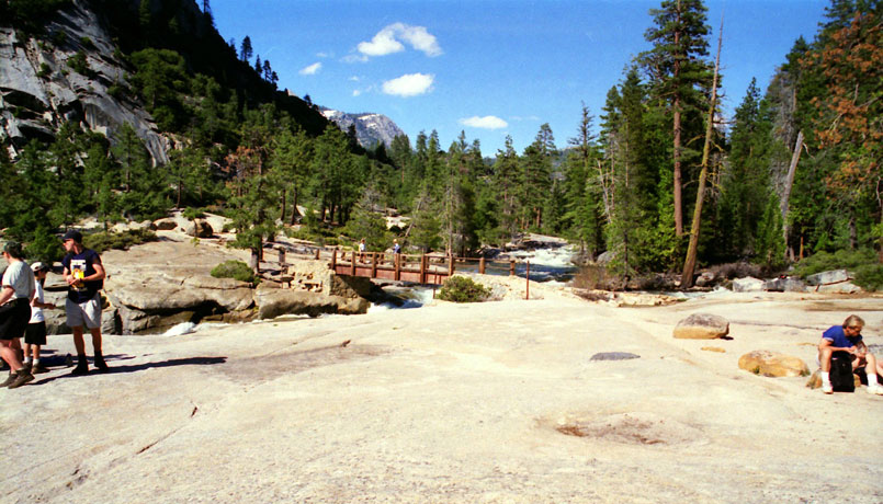
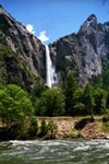
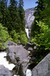
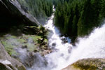
Vernal Fall from
John Muir Trail |
|
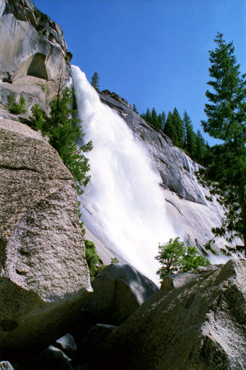
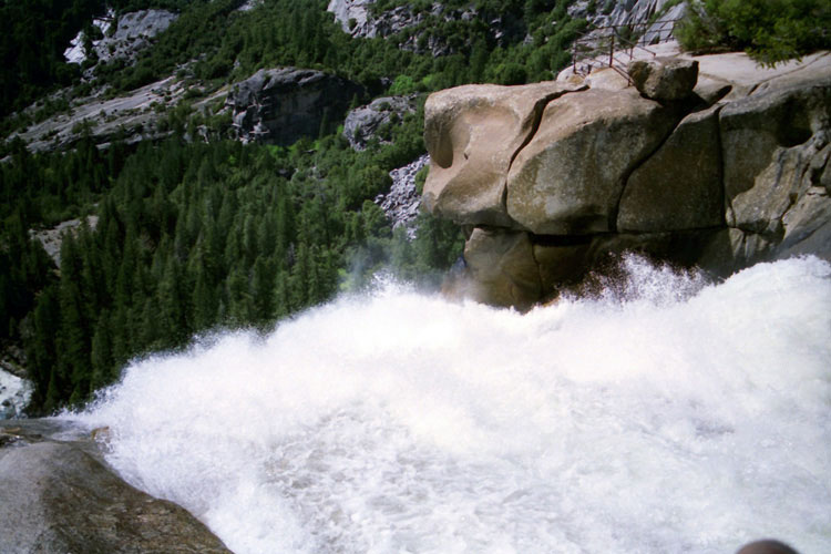
Vernal Fall
from Mist Trail |
|
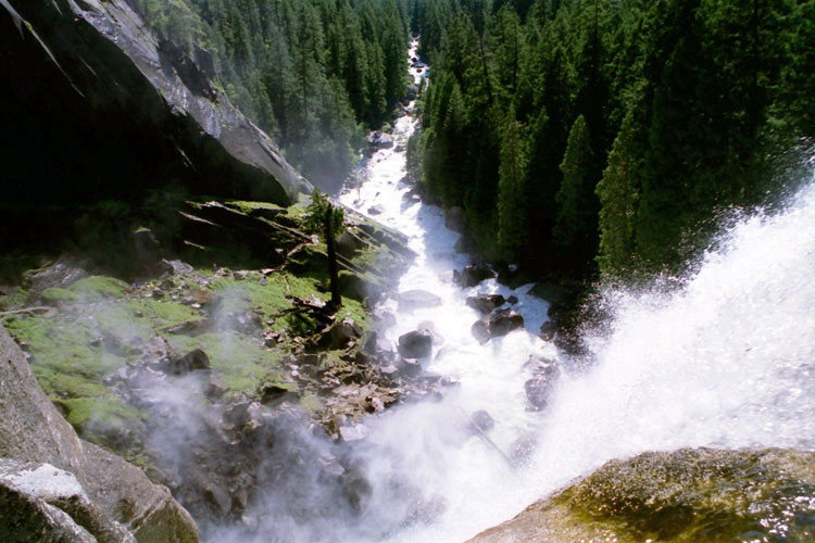
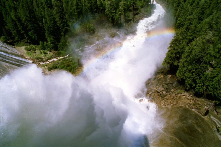
Merced River and Mist Trail
from top of Vernal Fall |
|
|
|
|
|
|
|
|
|
|
|
|
|
|
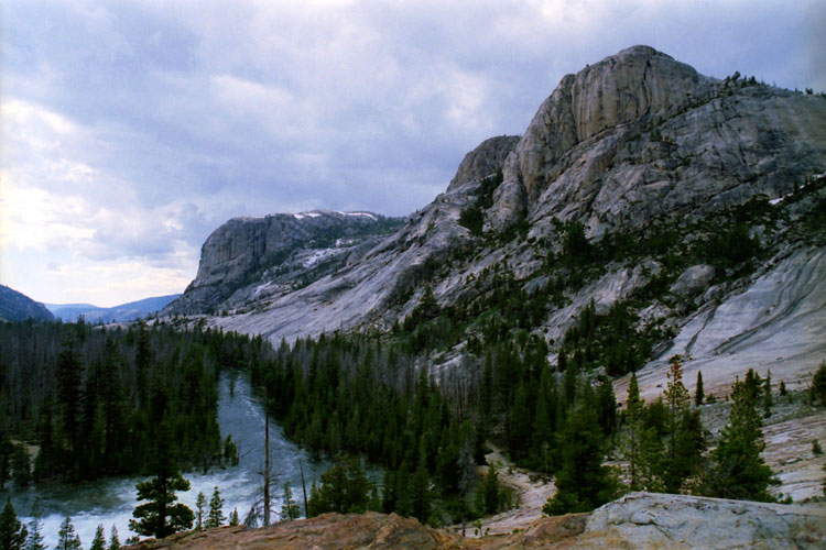
| Little Yosemite Valley - John Muir Trail |
|
 |
|
 |
|
 |
|
John Muir Trail into Little
Yosemite Valley along Merced
River (top of Nevada Fall) |
|
Half Dome from
Little Yosemite Valley |
|
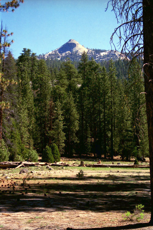
Mt. Starr King from
John Muir Trail |
|
|
|
|
| Half Dome - Half Dome Trail |
|
 |
|
 |
|
 |
|
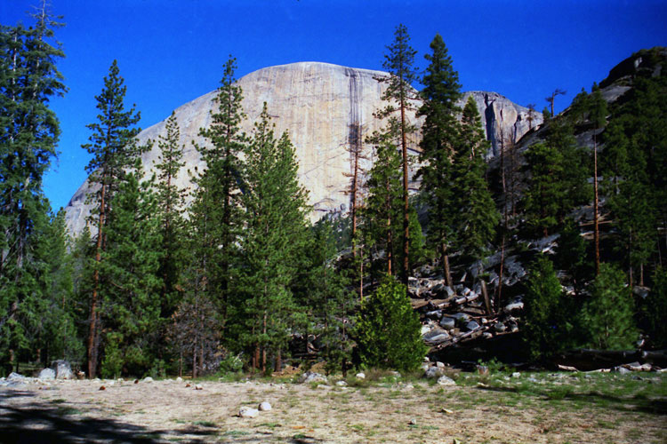
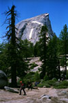
Half Dome and
Half Dome Trail |
|
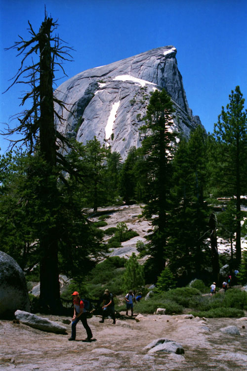
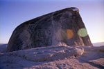
Half Dome summit and
Half Dome Cables |
|
Mt. Watkins, Tenaya Canyon
and Half Dome summit |
|
|
|
|
|
|
|
|
|
|
|
|
|
|
|
|
|
|
|
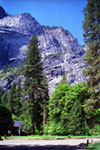
| Yosemite Lodge |
|
 |
|
|
|
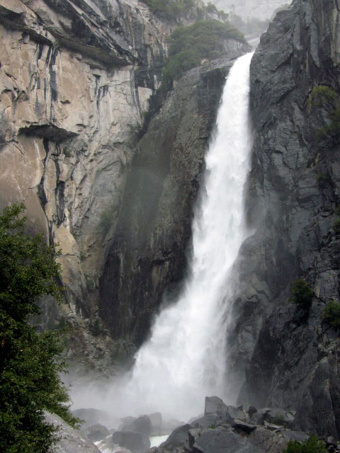
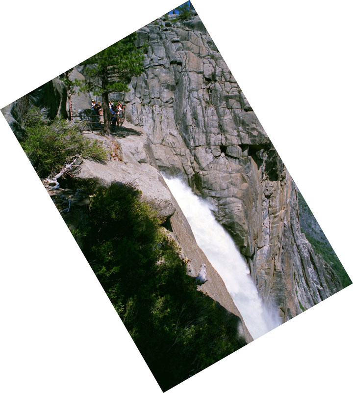
Yosemite Falls from
near Yosemite Lodge
(Shuttle Stop #7) |
|
|
|
|
|
|
|
|
|
|
| Yosemite Point - North Dome Trail |
|
 |
|
 |
|
Clouds Rest, North Dome, Half Dome, Mount Clark
and Mount Starr King from Yosemite Point |
|
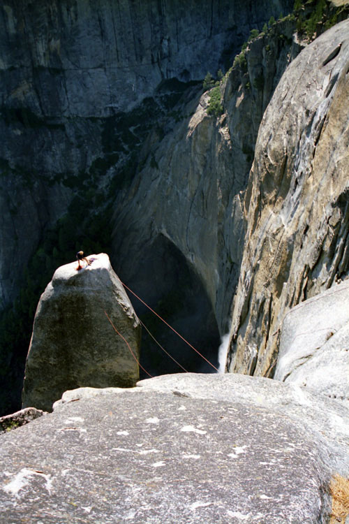
Lost Arrow Spire
from below
Yosemite Point |
|
|
|
|
| Valley View |
|
 |
|
 |
|
 |
|
El Capitan, Cathedral Rocks, Bridalveil Fall
and Merced River from Valley View |
|
|
|
|
|
|
|
|
|
|
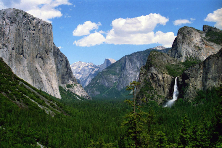
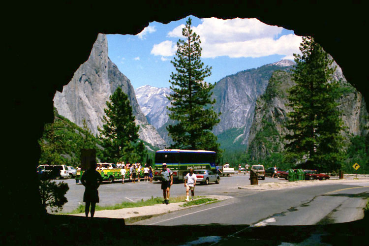
| Tunnel View |
|
 |
|
 |
|
 |
|
El Capitan, Clouds Rest, Half Dome, Sentinel Dome,
Cathedral Rocks, Bridalveil Fall and Yosemite Valley
from Tunnel View |
|
Wawona Tunnel and Wawona
Road (Highway 41) |
|
|
|
|
|
|
|
|
|
|
|
|
|
|
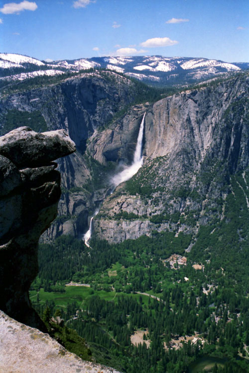
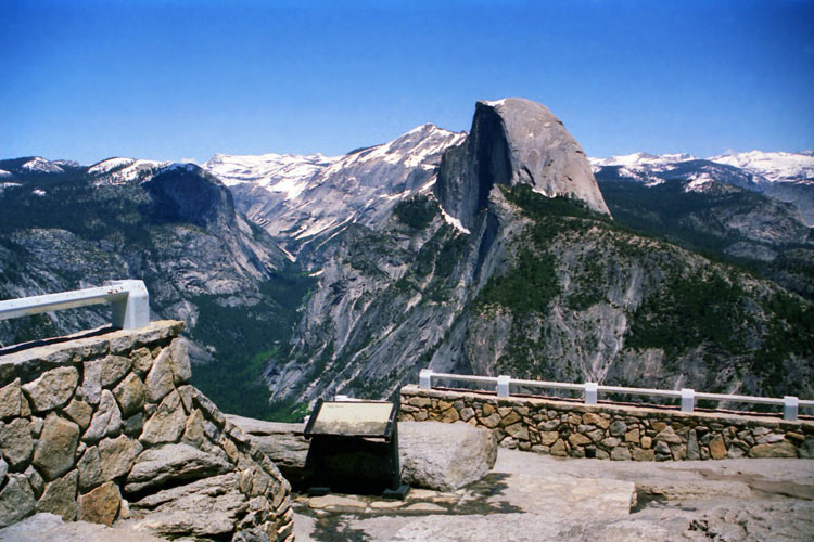
| Glacier Point |
|
 |
|
 |
|
 |
|
Yosemite Falls and
Yosemite Valley |
|
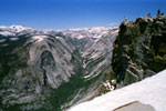
Tenaya Canyon and Half
Dome from Glacier Point |
|
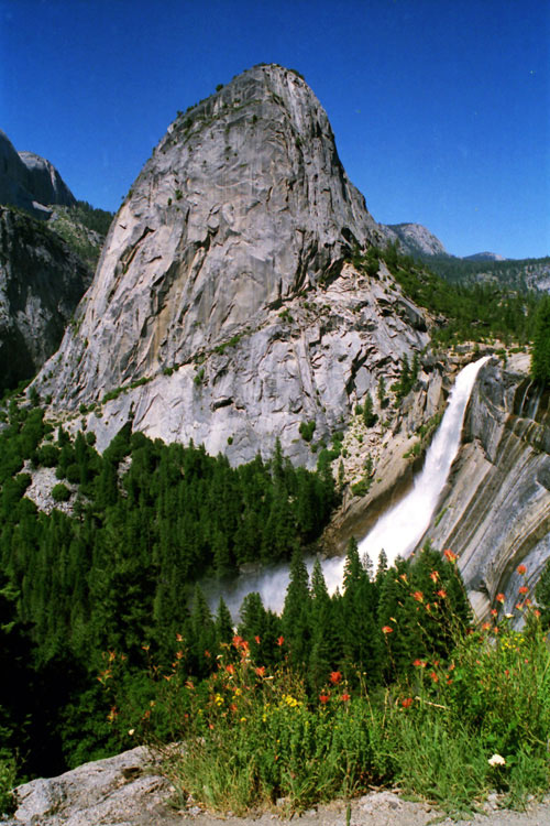
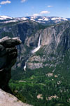
Nevada Fall
and Vernal Fall |
|
|
 |
|
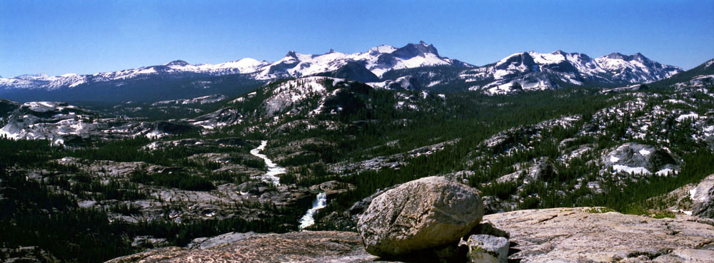
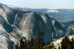
North Dome, Basket Dome, Mount Hoffmann, Mount Watkins, Tenaya Canyon,
Clouds Rest, Half Dome, Cathedral Range, Mount Clark and Nevada Fall
from Glacier Point |
|
|
|
|
|
|
|
|
|
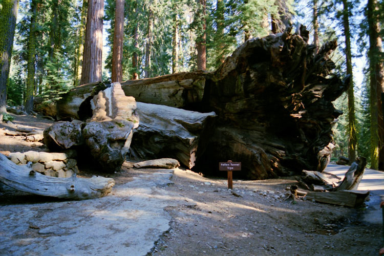
| Wawona |
|
 |
|
 |
|
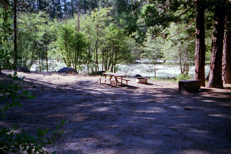
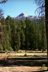
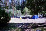
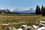
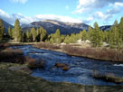
| South Fork Merced River and Wawona Campground |
|
|
|
|
|
|
|
|
|
|
|
|
|
|
|
|
|
|
|
| Hetch Hetchy Valley |
|
 |
|
 |
|
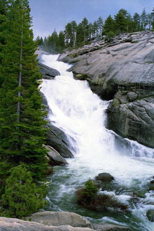
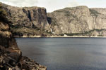
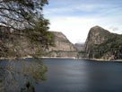
Wapama Falls, Hetch Hetchy Dome and
Hetch Hetchy Reservoir from O'Shaughnessy Dam |
|
|
|
|
| Hetch Hetchy Reservoir |
|
 |
|
 |
|
 |
|
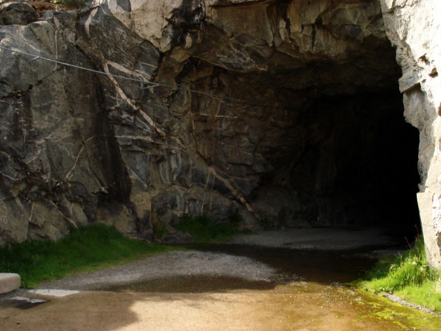
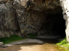
Tunnel of O'Shaughnessy
Dam (Wapama Falls Trail) |
|
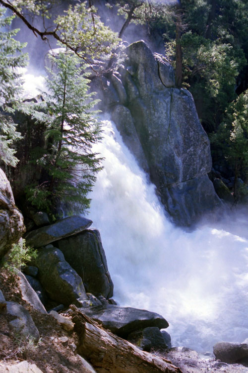
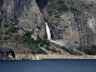
Wapama Falls and
Hetch Hetchy Reservoir |
|
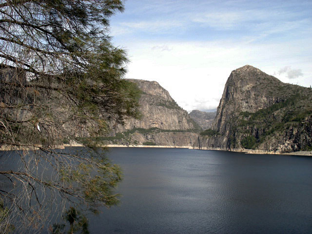
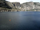
Hetch Hetchy Reservoir
and Kolana Rock |
|
|
|
|
|
|
|
|
|
|
|
|
|
|
|
|
|
|
|
|
|
|
|
|
|
|
|
|
|
|
|
|
|
|
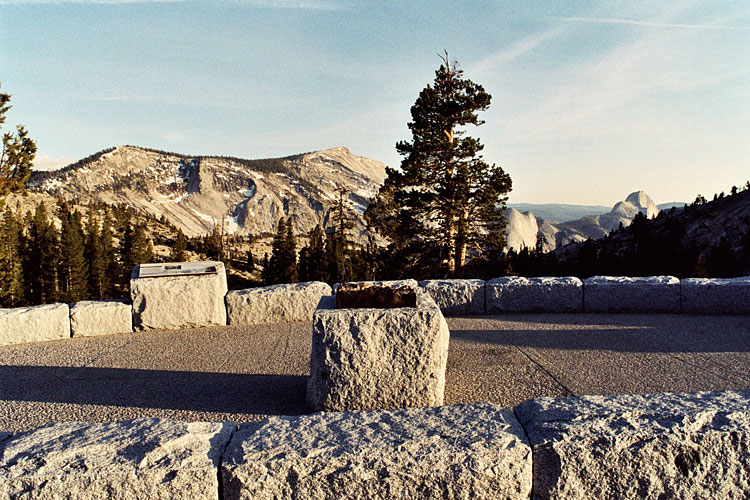
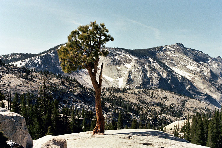
| Olmsted Point |
|
 |
|
 |
|
 |
|
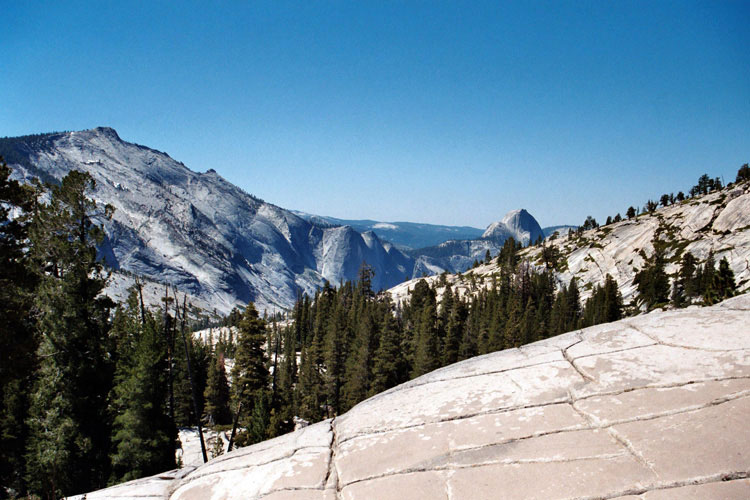
Clouds Rest, Quarter Domes and Half Dome
from Olmsted Point |
|
Clouds Rest |
|
|
 |
|
 |
|
 |
|
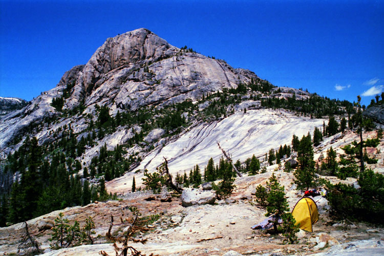
Quarter Domes
from Olmsted Point |
|
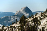
Half Dome |
|
Mt. Conness, Medlicott Dome,
Pywiack Dome and Tenaya
Lake from Olmsted Point |
|
|
|
|
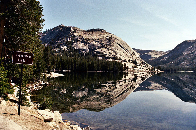
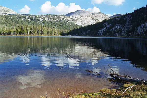
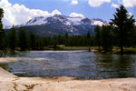
| Tenaya Lake |
|
 |
|
 |
|
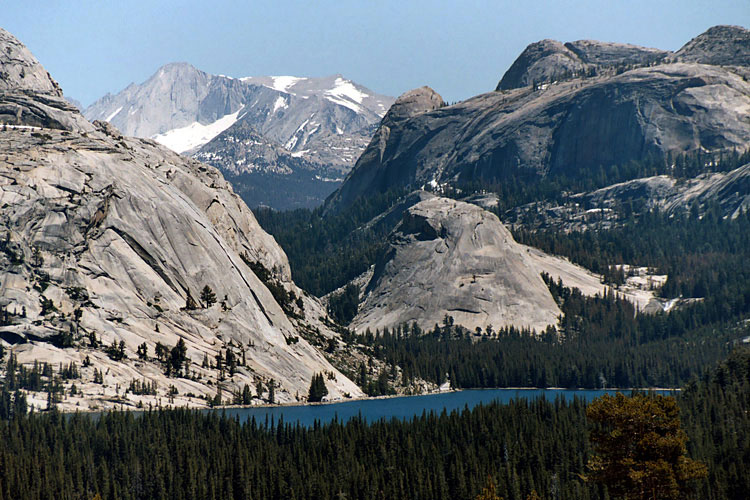
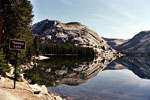
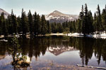
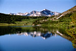
Polly Dome and Tenaya Lake
from Tioga Road |
|
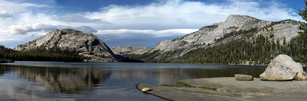
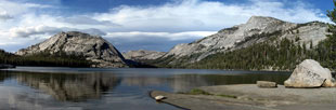
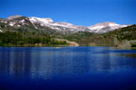
Polly Dome, Medlicott Dome, Tenaya Peak
and Tenaya Lake |
|
|
|
|
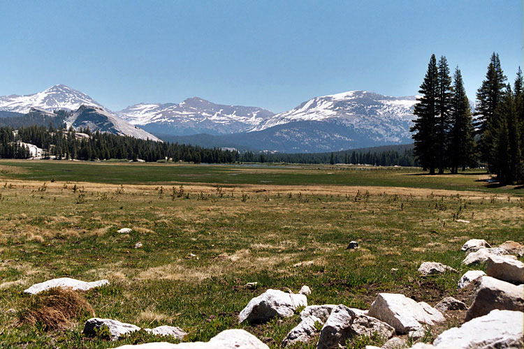
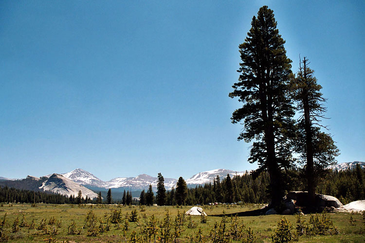
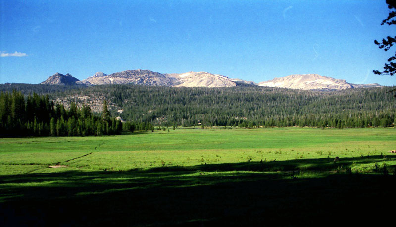
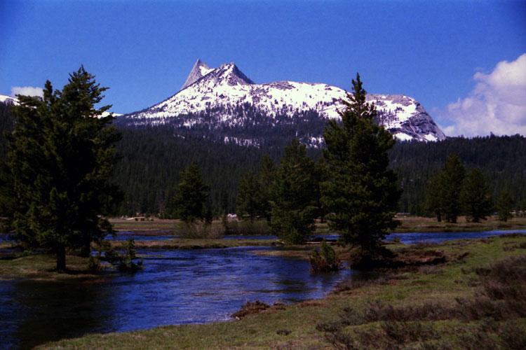
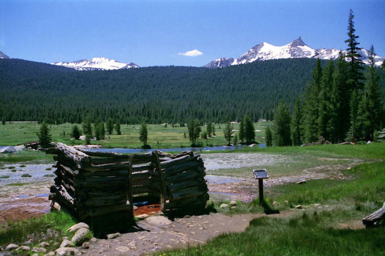
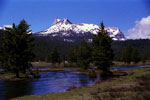
| Tuolumne Meadows |
|
 |
|
 |
|
 |
|
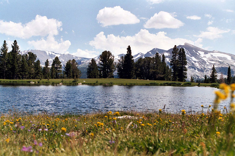
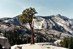
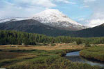
Mount Dana, Mount Gibbs, Mammoth Peak
and Lembert Dome from Tuolumne Meadows |
|
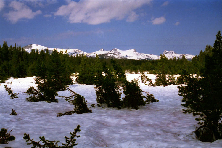
Ragged Peak, Mount Conness
and White Mountain
from Tuolumne Meadows |
|
|
 |
|
 |
|
 |
|
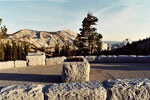
Lembert Dome,
Tuolumne Meadows Bridge
and Tioga Road |
|
Mammoth Peak
and Tuolumne River |
|
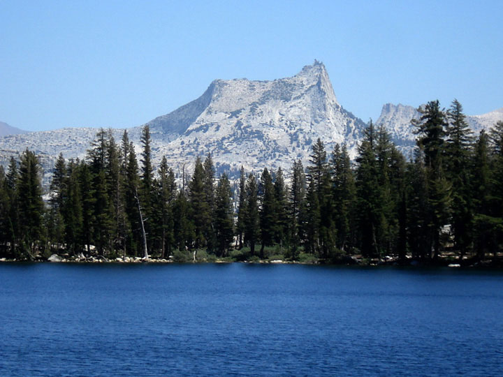
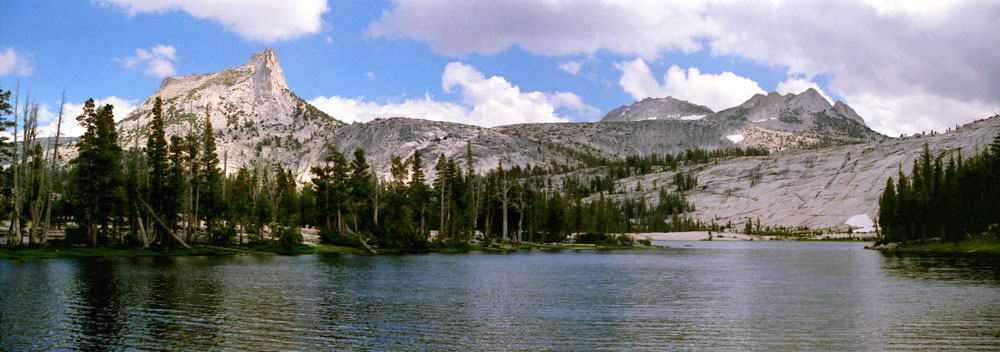
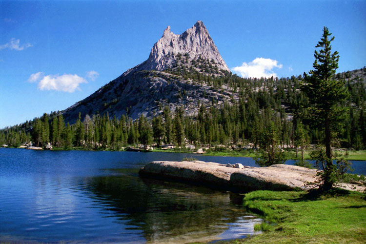
Cathedral Peak
and Tuolumne River |
|
|
|
|
| Tuolumne Meadows (Cont'd) |
|
 |
|
 |
|
 |
|
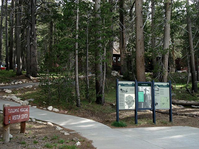
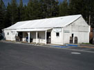
Tuolumne Meadows
Visitor Center |
|
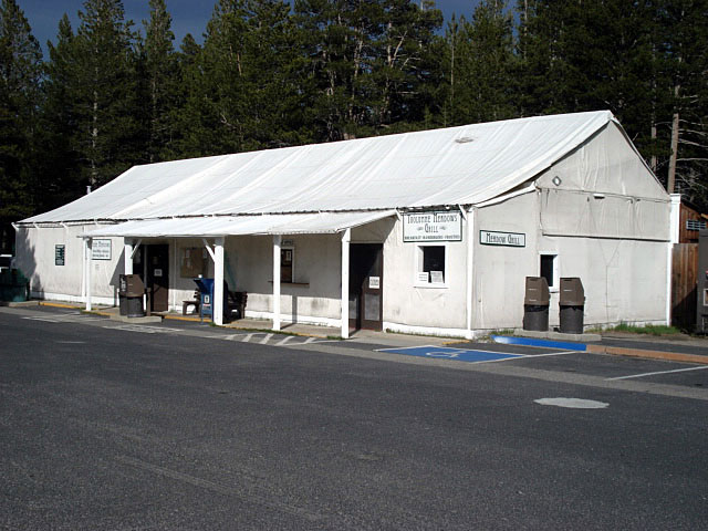
Tuolumne Meadows
Store and Grill |
|
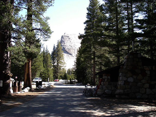
Lembert Dome and
Tuolumne Meadows
Camground Office |
|
|
 |
|
 |
|
 |
|
| Tuolumne Meadows Lodge |
|
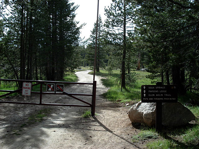
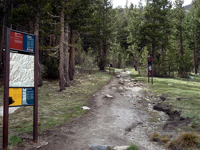
Glen Aulin Trail
(Pacific Crest Trail) |
|
Stables |
|
|
|
|
|
|
|
|
|
|
|
|
|
|
|
|
|
|
|
|
|
|
|
|
|
|
|
|
|
|
|
|
 |
|
 |
|
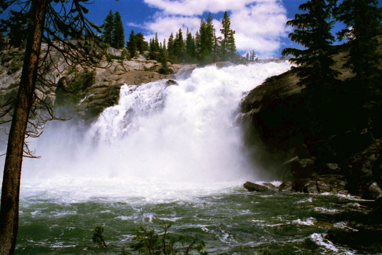
| Peak 8,886 near Glen Aulin |
|
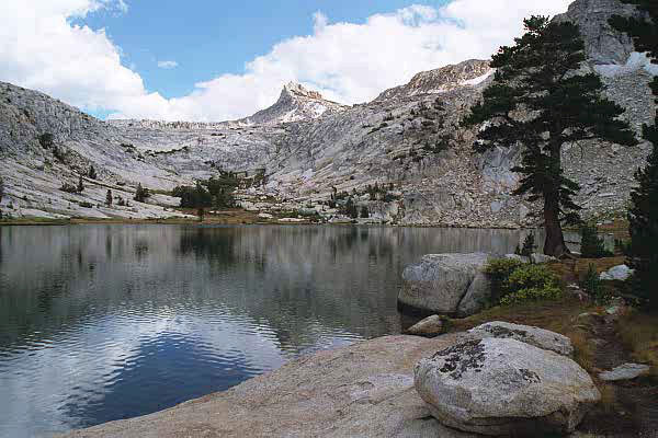
Cathedral Range and Tuolumne River
from Peak 8,886 summit |
|
|
|
|
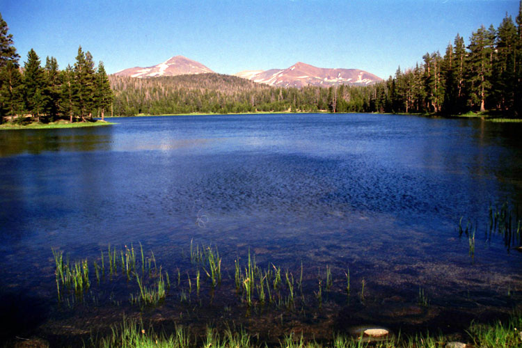
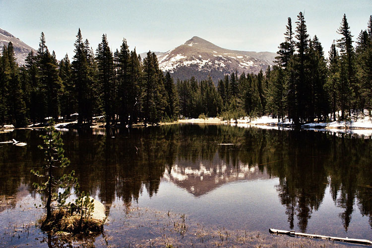
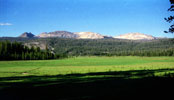
| Dana Meadows |
|
 |
|
 |
|
 |
|
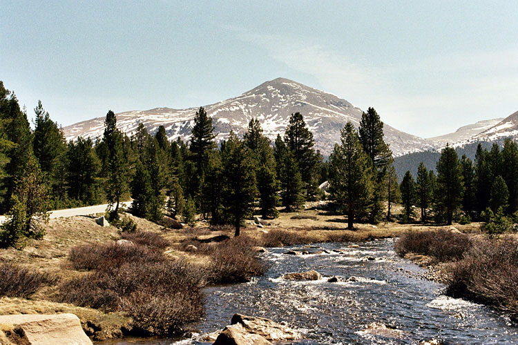
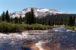
Mount Dana and Dana
Fork (Dana Meadows) |
|
Mount Gibbs
and Dana Fork |
|
Mammoth Peak
and Dana Fork |
|
|
 |
|
 |
|
 |
|
Cathedral Range
from Dana Meadows |
|
Mount Dana
and Dana Fork |
|
Mount Gibbs
from Dana Meadows |
|
|
|
|
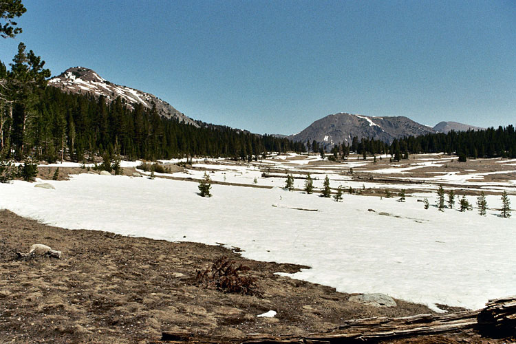
| Upper Dana Meadow (Dana Meadows) |
|
 |
|
 |
|
 |
|
Gaylor Peak, Tioga Peak,
Tioga Pass and Tioga Road
from Upper Dana Meadow |
|
Mount Dana and unnamed
lake near Tioga Pass |
|
Mammoth Peak and unnamed
lake near Tioga Pass |
|
|
|
|
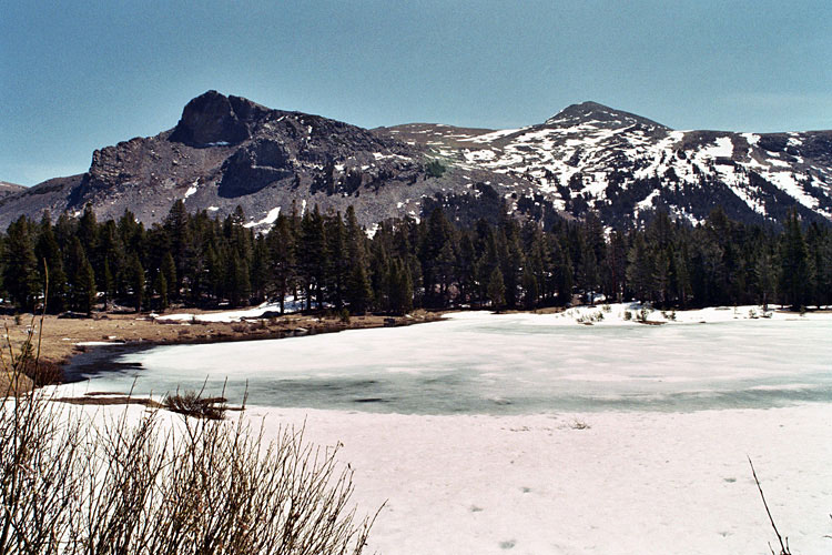
| Tioga Pass |
|
 |
|
 |
|
 |
|
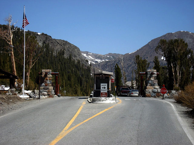
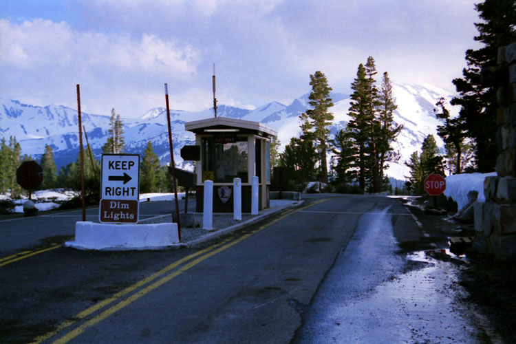
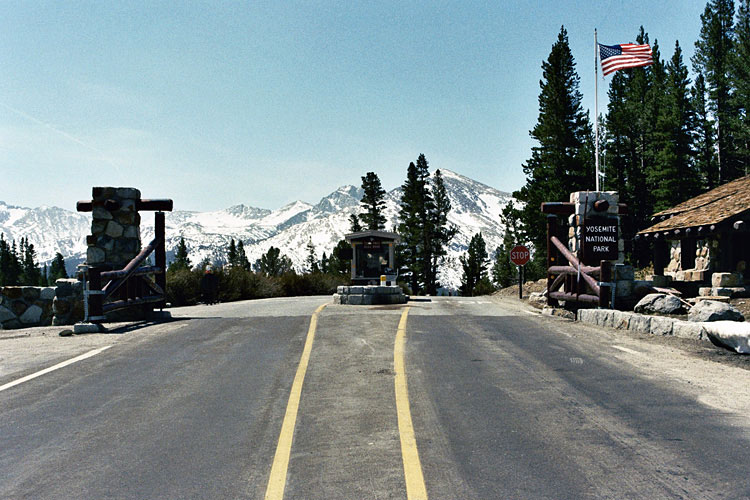
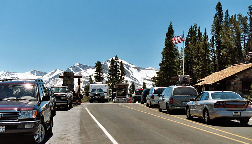
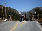
Tioga Pass Entrance
and Tioga Road |
|
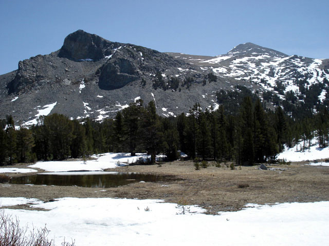
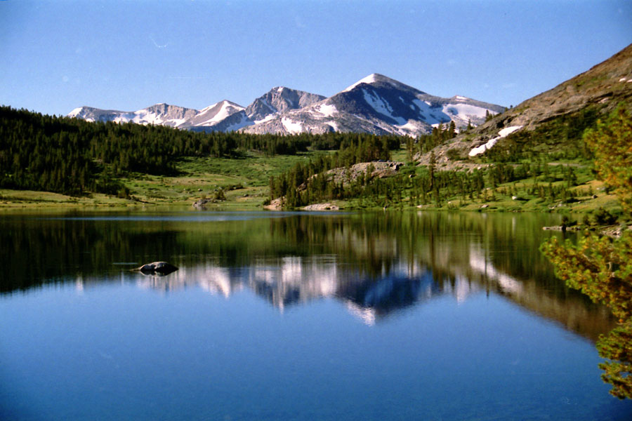
Mount Dana
from Tioga Pass |
|
Kuna Crest and Mammoth
Peak from Tioga Pass |
|
|
|
|
| Gaylor Lakes - Gaylor Lakes Trail |
|
 |
|
 |
|
 |
|
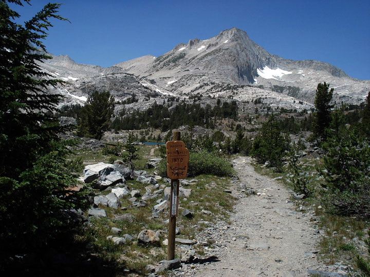
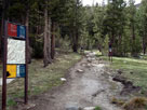
Gaylor Lakes Trailhead
at Tioga Pass |
|
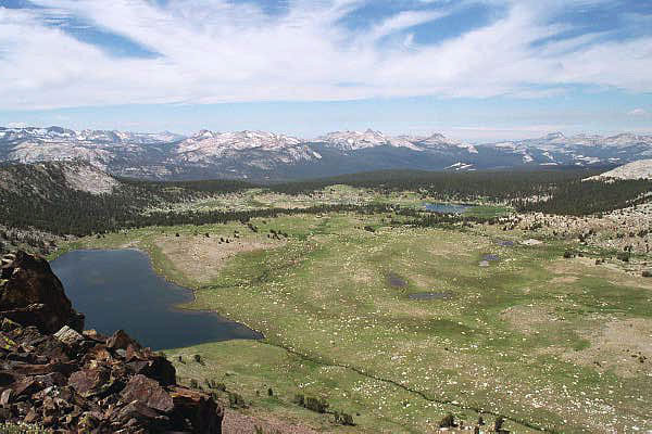
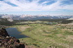
Mammoth Peak, Cathedral
Range, south ridge of Gaylor
Peak and Middle Gaylor Lake |
|
Cathedral Range and
Gaylor Lakes from
Gaylor Peak summit |
|
|
|
|
|
|
|
|
|
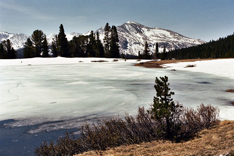
| "East of Yosemite" - Beyond Tioga Pass |
|
 |
|
 |
|
 |
|
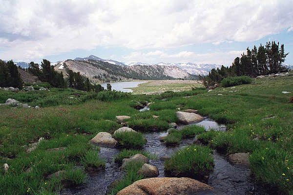
Mammoth Peak, Tioga Pass
and Tioga Lake |
|
White Mountain, Mount
Conness (southeast peak)
and Ellery Lake |
|
North Peak and
20 Lakes Basin Trail
(Hoover Wilderness) |
|
|
|
|
| See also |
|
|
|
|
|
|
|
| Yosemite National Park Photos on Web |
|
|
|
|